You are here: Home > Network List > CN - Canadian National Seismograph Network Stations List
> Station INK INUVIK, NT > Earthquake Result Viewer
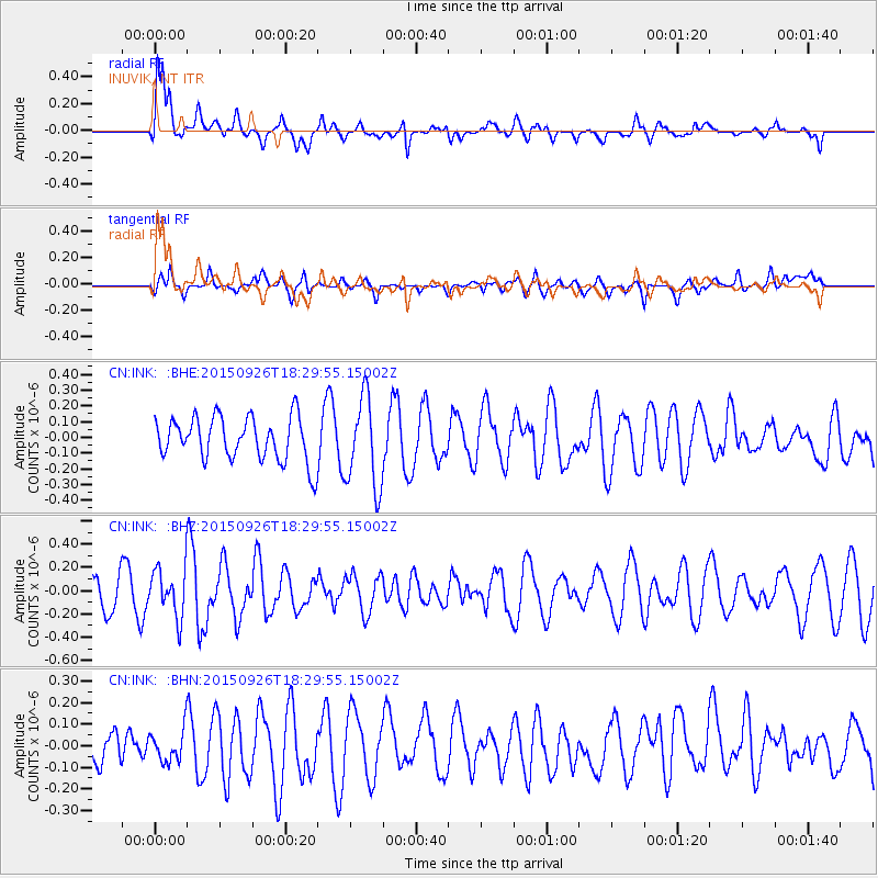
INK INUVIK, NT - Earthquake Result Viewer
*The percent match for this event was below the threshold and hence no stack was calculated.
| Earthquake location: |
New Britain Region, P.N.G. |
| Earthquake latitude/longitude: |
-6.3/151.7 |
| Earthquake time(UTC): |
2015/09/26 (269) 18:17:24 GMT |
| Earthquake Depth: |
2.8 km |
| Earthquake Magnitude: |
5.5 MB |
| Earthquake Catalog/Contributor: |
NEIC PDE/NEIC COMCAT |
|
| Network: |
CN Canadian National Seismograph Network |
| Station: |
INK INUVIK, NT |
| Lat/Lon: |
68.31 N/133.53 W |
| Elevation: |
44 m |
|
| Distance: |
90.2 deg |
| Az: |
21.026 deg |
| Baz: |
253.607 deg |
| Ray Param: |
$rayparam |
*The percent match for this event was below the threshold and hence was not used in the summary stack. |
|
| Radial Match: |
75.417946 % |
| Radial Bump: |
400 |
| Transverse Match: |
46.929226 % |
| Transverse Bump: |
366 |
| SOD ConfigId: |
7422571 |
| Insert Time: |
2019-04-21 00:57:00.531 +0000 |
| GWidth: |
2.5 |
| Max Bumps: |
400 |
| Tol: |
0.001 |
|
Signal To Noise
| Channel | StoN | STA | LTA |
| CN:INK: :BHZ:20150926T18:29:55.15002Z | 1.4934894 | 2.0484345E-7 | 1.3715761E-7 |
| CN:INK: :BHN:20150926T18:29:55.15002Z | 0.5780348 | 7.456697E-8 | 1.2900082E-7 |
| CN:INK: :BHE:20150926T18:29:55.15002Z | 2.0710332 | 2.8675197E-7 | 1.384584E-7 |
| Arrivals |
| Ps | |
| PpPs | |
| PsPs/PpSs | |


