NWAO Narrogin, Australia - Earthquake Result Viewer
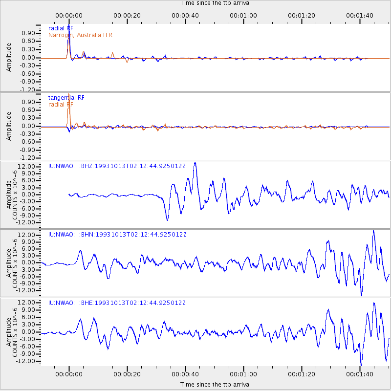
Earthquake location: Eastern New Guinea Reg., P.N.G.
Earthquake latitude/longitude: -5.9/146.0
Earthquake time(UTC): 1993/10/13 (286) 02:06:00 GMT
Earthquake Depth: 24 km
Earthquake Magnitude: 6.4 MB, 7.1 MS, 6.7 UNKNOWN, 7.1 ML
Earthquake Catalog/Contributor: WHDF/NEIC
Network: IU Global Seismograph Network (GSN - IRIS/USGS)
Station: NWAO Narrogin, Australia
Lat/Lon: 32.93 S/117.23 E
Elevation: 265 m
Distance: 37.9 deg
Az: 221.215 deg
Baz: 51.196 deg
Ray Param: 0.075812
Estimated Moho Depth: 54.5 km
Estimated Crust Vp/Vs: 1.60
Assumed Crust Vp: 6.419 km/s
Estimated Crust Vs: 4.012 km/s
Estimated Crust Poisson's Ratio: 0.18
Radial Match: 94.41697 %
Radial Bump: 237
Transverse Match: 73.22981 %
Transverse Bump: 400
SOD ConfigId: 16938
Insert Time: 2010-03-04 20:44:44.321 +0000
GWidth: 2.5
Max Bumps: 400
Tol: 0.001

Signal To Noise

ChannelStoNSTALTA
IU:NWAO: :BHN:19931013T02:12:44.925012Z7.46461732.5135016E-63.3672214E-7
IU:NWAO: :BHE:19931013T02:12:44.925012Z6.25030042.375676E-63.800899E-7
IU:NWAO: :BHZ:19931013T02:12:44.925012Z11.7763314.6656605E-63.9618968E-7
Arrivals
Ps5.5 SECOND
PpPs20 SECOND
PsPs/PpSs26 SECOND