You are here: Home > Network List > CI - Caltech Regional Seismic Network Stations List
> Station GSC Goldstone, Goldstone Lake, CA, USA > Earthquake Result Viewer
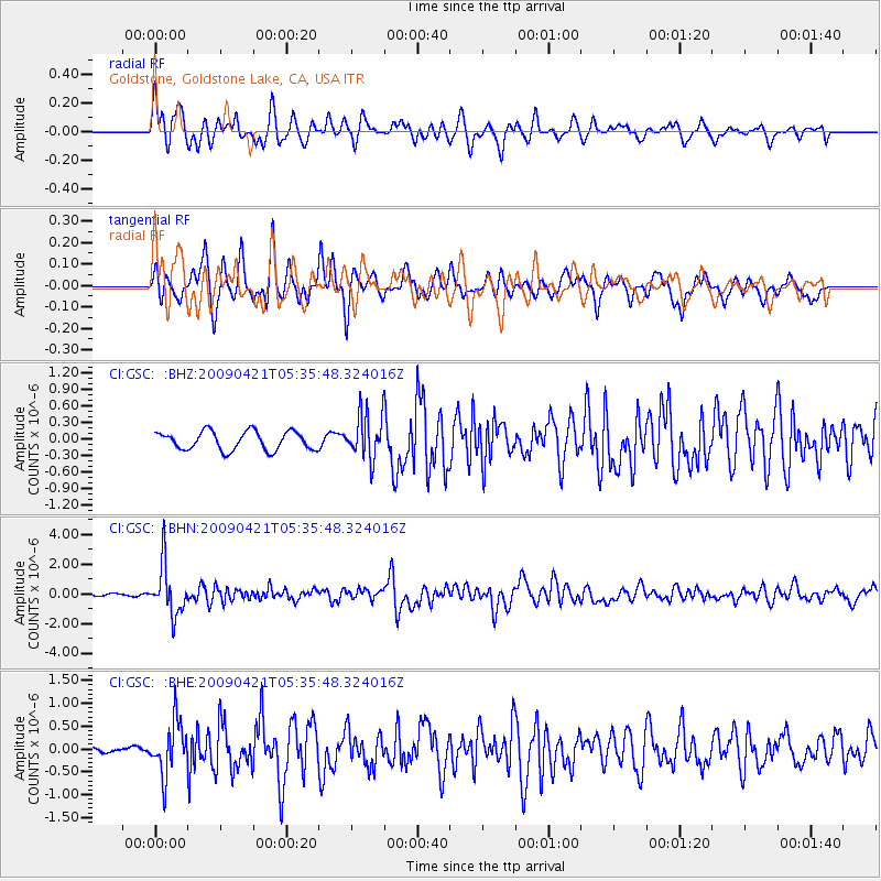
GSC Goldstone, Goldstone Lake, CA, USA - Earthquake Result Viewer
*The percent match for this event was below the threshold and hence no stack was calculated.
| Earthquake location: |
Kuril Islands |
| Earthquake latitude/longitude: |
50.8/155.0 |
| Earthquake time(UTC): |
2009/04/21 (111) 05:26:11 GMT |
| Earthquake Depth: |
152 km |
| Earthquake Magnitude: |
6.0 MB, 6.2 MW, 6.2 MW |
| Earthquake Catalog/Contributor: |
WHDF/NEIC |
|
| Network: |
CI Caltech Regional Seismic Network |
| Station: |
GSC Goldstone, Goldstone Lake, CA, USA |
| Lat/Lon: |
35.30 N/116.81 W |
| Elevation: |
1000 m |
|
| Distance: |
62.5 deg |
| Az: |
67.133 deg |
| Baz: |
314.41 deg |
| Ray Param: |
$rayparam |
*The percent match for this event was below the threshold and hence was not used in the summary stack. |
|
| Radial Match: |
78.66853 % |
| Radial Bump: |
400 |
| Transverse Match: |
82.04476 % |
| Transverse Bump: |
400 |
| SOD ConfigId: |
2760 |
| Insert Time: |
2010-02-25 23:50:04.739 +0000 |
| GWidth: |
2.5 |
| Max Bumps: |
400 |
| Tol: |
0.001 |
|
Signal To Noise
| Channel | StoN | STA | LTA |
| CI:GSC: :BHN:20090421T05:35:48.324016Z | 12.699613 | 1.6586031E-6 | 1.3060264E-7 |
| CI:GSC: :BHE:20090421T05:35:48.324016Z | 4.1752787 | 5.7622236E-7 | 1.3800812E-7 |
| CI:GSC: :BHZ:20090421T05:35:48.324016Z | 2.4275556 | 4.111676E-7 | 1.6937516E-7 |
| Arrivals |
| Ps | |
| PpPs | |
| PsPs/PpSs | |


