NWAO Narrogin, Australia - Earthquake Result Viewer
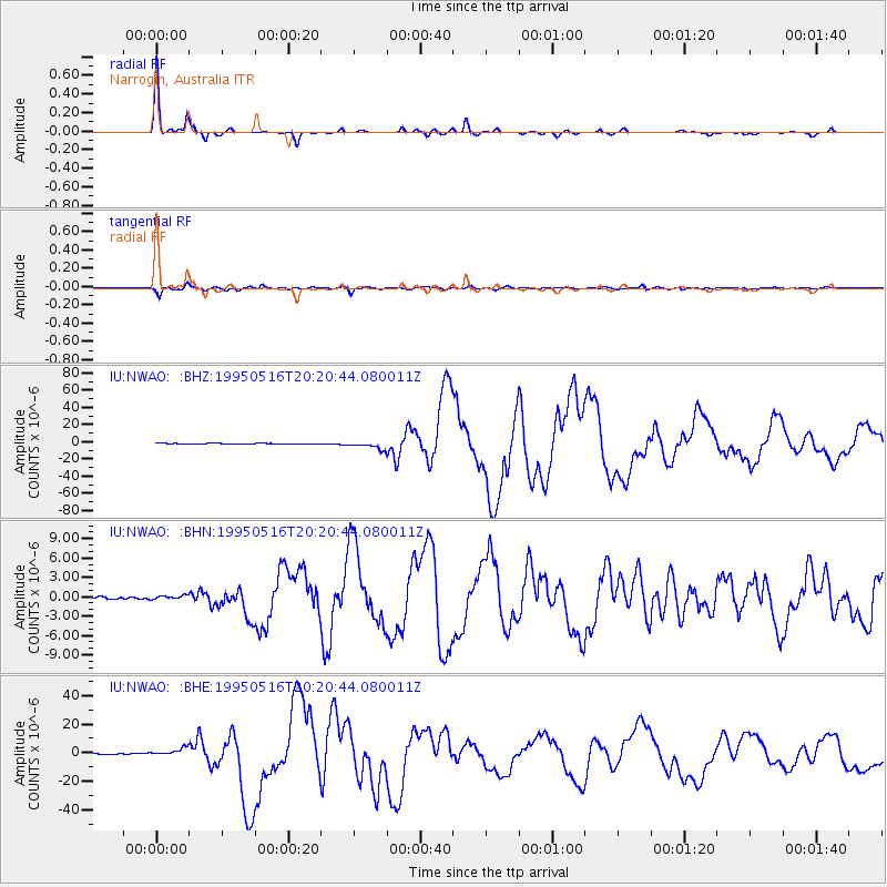
Earthquake location: Southeast Of Loyalty Islands
Earthquake latitude/longitude: -23.0/169.9
Earthquake time(UTC): 1995/05/16 (136) 20:12:45 GMT
Earthquake Depth: 33 km
Earthquake Magnitude: 6.8 MB, 7.7 MS, 7.7 UNKNOWN, 7.7 MW
Earthquake Catalog/Contributor: WHDF/NEIC
Network: IU Global Seismograph Network (GSN - IRIS/USGS)
Station: NWAO Narrogin, Australia
Lat/Lon: 32.93 S/117.23 E
Elevation: 265 m
Distance: 47.1 deg
Az: 245.826 deg
Baz: 91.924 deg
Ray Param: 0.07012621
Estimated Moho Depth: 42.25 km
Estimated Crust Vp/Vs: 1.69
Assumed Crust Vp: 6.419 km/s
Estimated Crust Vs: 3.793 km/s
Estimated Crust Poisson's Ratio: 0.23
Radial Match: 98.231384 %
Radial Bump: 181
Transverse Match: 94.782776 %
Transverse Bump: 400
SOD ConfigId: 6273
Insert Time: 2010-03-04 20:45:37.748 +0000
GWidth: 2.5
Max Bumps: 400
Tol: 0.001

Signal To Noise

ChannelStoNSTALTA
IU:NWAO: :BHN:19950516T20:20:44.080011Z2.02835183.5213225E-71.7360512E-7
IU:NWAO: :BHE:19950516T20:20:44.080011Z11.4129983.0266228E-62.6519086E-7
IU:NWAO: :BHZ:19950516T20:20:44.080011Z9.2113664.523054E-64.9102965E-7
Arrivals
Ps4.9 SECOND
PpPs17 SECOND
PsPs/PpSs21 SECOND