
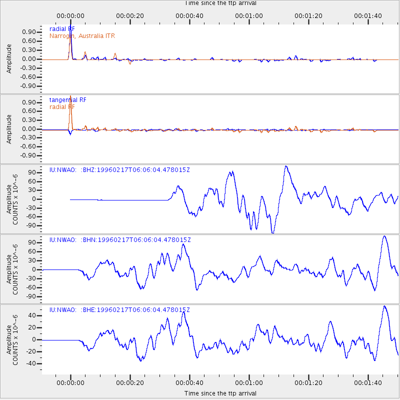
NWAO Narrogin, Australia - Earthquake Result Viewer
| ||||||||||||||||||
| ||||||||||||||||||
| ||||||||||||||||||
|
Signal To Noise
| Channel | StoN | STA | LTA |
| IU:NWAO: :BHN:19960217T06:06:04.478015Z | 16.278154 | 5.302182E-6 | 3.257238E-7 |
| IU:NWAO: :BHE:19960217T06:06:04.478015Z | 13.368927 | 2.8329573E-6 | 2.1190611E-7 |
| IU:NWAO: :BHZ:19960217T06:06:04.478015Z | 11.817054 | 8.4629155E-6 | 7.1616125E-7 |
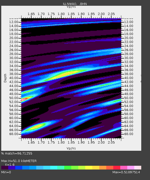
| Arrivals | |
| Ps | 5.2 SECOND |
| PpPs | 19 SECOND |
| PsPs/PpSs | 24 SECOND |

