
NWAO Narrogin, Australia - Earthquake Result Viewer
| ||||||||||||||||||
| ||||||||||||||||||
| ||||||||||||||||||
|
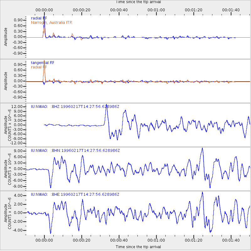
Signal To Noise
| Channel | StoN | STA | LTA |
| IU:NWAO: :BHN:19960217T14:27:56.628986Z | 14.994304 | 3.688739E-6 | 2.4600936E-7 |
| IU:NWAO: :BHE:19960217T14:27:56.628986Z | 7.2397494 | 1.7410587E-6 | 2.4048603E-7 |
| IU:NWAO: :BHZ:19960217T14:27:56.628986Z | 16.786112 | 5.429063E-6 | 3.2342587E-7 |
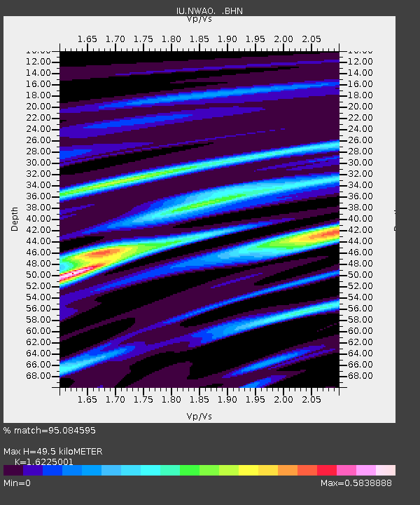
| Arrivals | |
| Ps | 5.2 SECOND |
| PpPs | 19 SECOND |
| PsPs/PpSs | 24 SECOND |

