You are here: Home > Network List > CI - Caltech Regional Seismic Network Stations List
> Station DGR Domenigoni Reservoir, California, USA > Earthquake Result Viewer
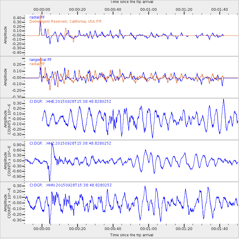
DGR Domenigoni Reservoir, California, USA - Earthquake Result Viewer
*The percent match for this event was below the threshold and hence no stack was calculated.
| Earthquake location: |
Jujuy Province, Argentina |
| Earthquake latitude/longitude: |
-23.8/-66.6 |
| Earthquake time(UTC): |
2015/09/28 (271) 15:28:05 GMT |
| Earthquake Depth: |
219 km |
| Earthquake Magnitude: |
5.9 MWW, 6.0 MWB, 6.0 MWC |
| Earthquake Catalog/Contributor: |
NEIC PDE/NEIC COMCAT |
|
| Network: |
CI Caltech Regional Seismic Network |
| Station: |
DGR Domenigoni Reservoir, California, USA |
| Lat/Lon: |
33.65 N/117.01 W |
| Elevation: |
609 m |
|
| Distance: |
74.6 deg |
| Az: |
318.172 deg |
| Baz: |
132.918 deg |
| Ray Param: |
$rayparam |
*The percent match for this event was below the threshold and hence was not used in the summary stack. |
|
| Radial Match: |
64.150375 % |
| Radial Bump: |
353 |
| Transverse Match: |
59.652287 % |
| Transverse Bump: |
400 |
| SOD ConfigId: |
7422571 |
| Insert Time: |
2019-04-21 01:10:01.545 +0000 |
| GWidth: |
2.5 |
| Max Bumps: |
400 |
| Tol: |
0.001 |
|
Signal To Noise
| Channel | StoN | STA | LTA |
| CI:DGR: :HHZ:20150928T15:38:48.828025Z | 6.905765 | 3.968118E-7 | 5.7460948E-8 |
| CI:DGR: :HHN:20150928T15:38:48.828025Z | 1.9388038 | 1.3781634E-7 | 7.1083186E-8 |
| CI:DGR: :HHE:20150928T15:38:48.828025Z | 1.0256897 | 1.1459508E-7 | 1.117249E-7 |
| Arrivals |
| Ps | |
| PpPs | |
| PsPs/PpSs | |


