
NWAO Narrogin, Australia - Earthquake Result Viewer
| ||||||||||||||||||
| ||||||||||||||||||
| ||||||||||||||||||
|
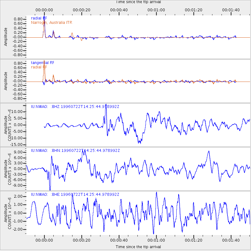
Signal To Noise
| Channel | StoN | STA | LTA |
| IU:NWAO: :BHN:19960722T14:25:44.978992Z | 5.0573044 | 4.4654057E-6 | 8.829616E-7 |
| IU:NWAO: :BHE:19960722T14:25:44.978992Z | 0.9663143 | 7.654146E-7 | 7.9209696E-7 |
| IU:NWAO: :BHZ:19960722T14:25:44.978992Z | 6.7639036 | 6.1459227E-6 | 9.0863546E-7 |
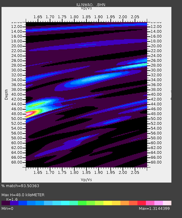
| Arrivals | |
| Ps | 4.9 SECOND |
| PpPs | 18 SECOND |
| PsPs/PpSs | 23 SECOND |

