
NWAO Narrogin, Australia - Earthquake Result Viewer
| ||||||||||||||||||
| ||||||||||||||||||
| ||||||||||||||||||
|
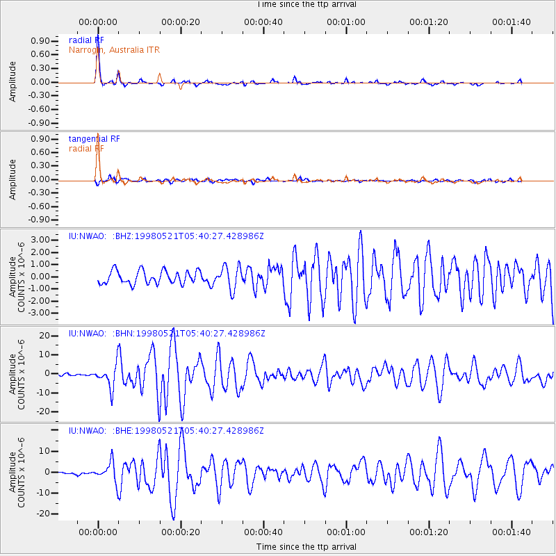
Signal To Noise
| Channel | StoN | STA | LTA |
| IU:NWAO: :BHN:19980521T05:40:27.428986Z | 6.8461423 | 6.423786E-6 | 9.3830744E-7 |
| IU:NWAO: :BHE:19980521T05:40:27.428986Z | 10.407246 | 4.9284595E-6 | 4.7356042E-7 |
| IU:NWAO: :BHZ:19980521T05:40:27.428986Z | 1.8461376 | 9.852135E-7 | 5.3366205E-7 |
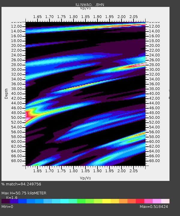
| Arrivals | |
| Ps | 5.2 SECOND |
| PpPs | 19 SECOND |
| PsPs/PpSs | 24 SECOND |

