You are here: Home > Network List > TA - USArray Transportable Network (new EarthScope stations) Stations List
> Station L44A Lake County Forest Preserve, Grayslake, IL, USA > Earthquake Result Viewer
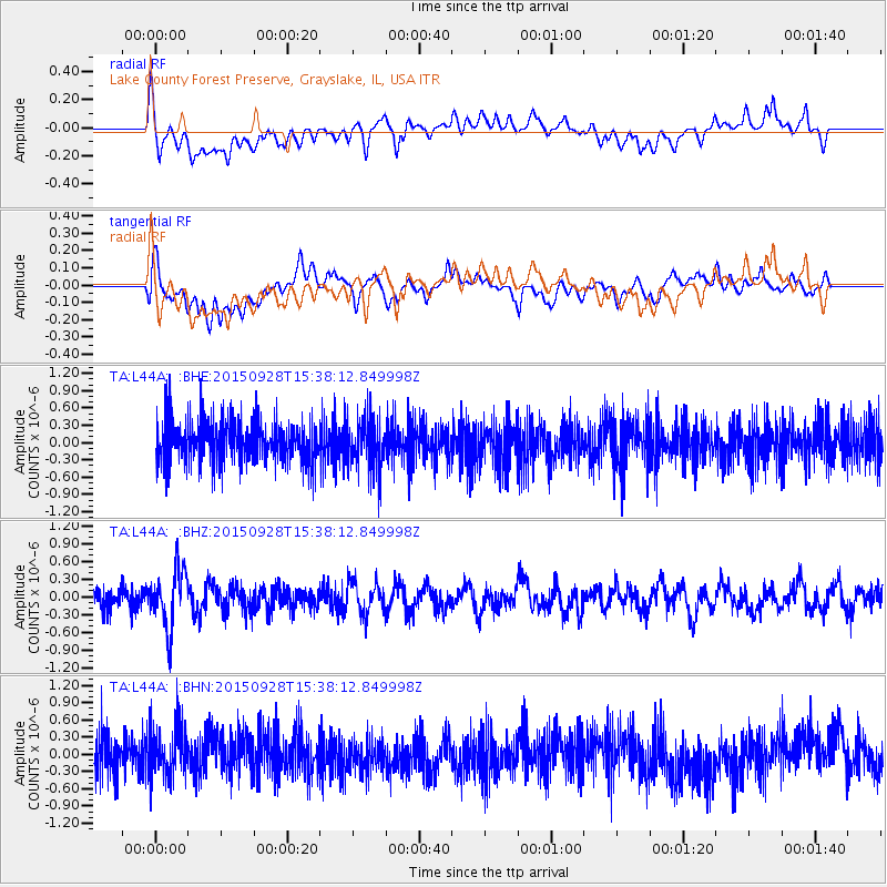
L44A Lake County Forest Preserve, Grayslake, IL, USA - Earthquake Result Viewer
*The percent match for this event was below the threshold and hence no stack was calculated.
| Earthquake location: |
Jujuy Province, Argentina |
| Earthquake latitude/longitude: |
-23.8/-66.6 |
| Earthquake time(UTC): |
2015/09/28 (271) 15:28:05 GMT |
| Earthquake Depth: |
219 km |
| Earthquake Magnitude: |
5.9 MWW, 6.0 MWB, 6.0 MWC |
| Earthquake Catalog/Contributor: |
NEIC PDE/NEIC COMCAT |
|
| Network: |
TA USArray Transportable Network (new EarthScope stations) |
| Station: |
L44A Lake County Forest Preserve, Grayslake, IL, USA |
| Lat/Lon: |
42.18 N/87.91 W |
| Elevation: |
202 m |
|
| Distance: |
68.5 deg |
| Az: |
343.114 deg |
| Baz: |
159.025 deg |
| Ray Param: |
$rayparam |
*The percent match for this event was below the threshold and hence was not used in the summary stack. |
|
| Radial Match: |
51.828785 % |
| Radial Bump: |
400 |
| Transverse Match: |
45.283012 % |
| Transverse Bump: |
400 |
| SOD ConfigId: |
7422571 |
| Insert Time: |
2019-04-21 01:15:38.850 +0000 |
| GWidth: |
2.5 |
| Max Bumps: |
400 |
| Tol: |
0.001 |
|
Signal To Noise
| Channel | StoN | STA | LTA |
| TA:L44A: :BHZ:20150928T15:38:12.849998Z | 2.833114 | 4.992632E-7 | 1.762242E-7 |
| TA:L44A: :BHN:20150928T15:38:12.849998Z | 1.2510097 | 4.6641705E-7 | 3.7283246E-7 |
| TA:L44A: :BHE:20150928T15:38:12.849998Z | 1.1625608 | 4.427609E-7 | 3.8084966E-7 |
| Arrivals |
| Ps | |
| PpPs | |
| PsPs/PpSs | |


