You are here: Home > Network List > TA - USArray Transportable Network (new EarthScope stations) Stations List
> Station O03E Paynes Creek, CA, USA > Earthquake Result Viewer
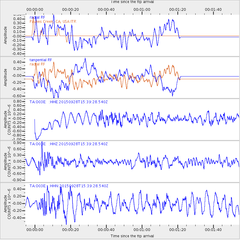
O03E Paynes Creek, CA, USA - Earthquake Result Viewer
*The percent match for this event was below the threshold and hence no stack was calculated.
| Earthquake location: |
Jujuy Province, Argentina |
| Earthquake latitude/longitude: |
-23.8/-66.6 |
| Earthquake time(UTC): |
2015/09/28 (271) 15:28:05 GMT |
| Earthquake Depth: |
219 km |
| Earthquake Magnitude: |
5.9 MWW, 6.0 MWB, 6.0 MWC |
| Earthquake Catalog/Contributor: |
NEIC PDE/NEIC COMCAT |
|
| Network: |
TA USArray Transportable Network (new EarthScope stations) |
| Station: |
O03E Paynes Creek, CA, USA |
| Lat/Lon: |
40.29 N/121.80 W |
| Elevation: |
967 m |
|
| Distance: |
81.9 deg |
| Az: |
320.612 deg |
| Baz: |
130.54 deg |
| Ray Param: |
$rayparam |
*The percent match for this event was below the threshold and hence was not used in the summary stack. |
|
| Radial Match: |
47.749435 % |
| Radial Bump: |
400 |
| Transverse Match: |
42.510433 % |
| Transverse Bump: |
400 |
| SOD ConfigId: |
7422571 |
| Insert Time: |
2019-04-21 01:15:43.577 +0000 |
| GWidth: |
2.5 |
| Max Bumps: |
400 |
| Tol: |
0.001 |
|
Signal To Noise
| Channel | StoN | STA | LTA |
| TA:O03E: :HHZ:20150928T15:39:28.540Z | 2.3519077 | 3.3074454E-7 | 1.4062819E-7 |
| TA:O03E: :HHN:20150928T15:39:28.540Z | 0.7693378 | 1.1583628E-7 | 1.5056622E-7 |
| TA:O03E: :HHE:20150928T15:39:28.540Z | 0.84140795 | 2.8398264E-7 | 3.3750885E-7 |
| Arrivals |
| Ps | |
| PpPs | |
| PsPs/PpSs | |


