You are here: Home > Network List > US - United States National Seismic Network Stations List
> Station DGMT Dagmar, Montana, USA > Earthquake Result Viewer
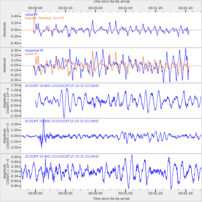
DGMT Dagmar, Montana, USA - Earthquake Result Viewer
*The percent match for this event was below the threshold and hence no stack was calculated.
| Earthquake location: |
Jujuy Province, Argentina |
| Earthquake latitude/longitude: |
-23.8/-66.6 |
| Earthquake time(UTC): |
2015/09/28 (271) 15:28:05 GMT |
| Earthquake Depth: |
219 km |
| Earthquake Magnitude: |
5.9 MWW, 6.0 MWB, 6.0 MWC |
| Earthquake Catalog/Contributor: |
NEIC PDE/NEIC COMCAT |
|
| Network: |
US United States National Seismic Network |
| Station: |
DGMT Dagmar, Montana, USA |
| Lat/Lon: |
48.47 N/104.20 W |
| Elevation: |
0.0 m |
|
| Distance: |
79.4 deg |
| Az: |
335.596 deg |
| Baz: |
145.342 deg |
| Ray Param: |
$rayparam |
*The percent match for this event was below the threshold and hence was not used in the summary stack. |
|
| Radial Match: |
51.24617 % |
| Radial Bump: |
400 |
| Transverse Match: |
61.195747 % |
| Transverse Bump: |
368 |
| SOD ConfigId: |
7422571 |
| Insert Time: |
2019-04-21 01:16:20.483 +0000 |
| GWidth: |
2.5 |
| Max Bumps: |
400 |
| Tol: |
0.001 |
|
Signal To Noise
| Channel | StoN | STA | LTA |
| US:DGMT:00:BHZ:20150928T15:39:15.623984Z | 3.1314306 | 5.4768583E-7 | 1.7489957E-7 |
| US:DGMT:00:BH1:20150928T15:39:15.623984Z | 0.6085209 | 2.9132258E-7 | 4.787388E-7 |
| US:DGMT:00:BH2:20150928T15:39:15.623984Z | 0.80855525 | 4.526541E-7 | 5.5983077E-7 |
| Arrivals |
| Ps | |
| PpPs | |
| PsPs/PpSs | |


