
NWAO Narrogin, Australia - Earthquake Result Viewer
| ||||||||||||||||||
| ||||||||||||||||||
| ||||||||||||||||||
|
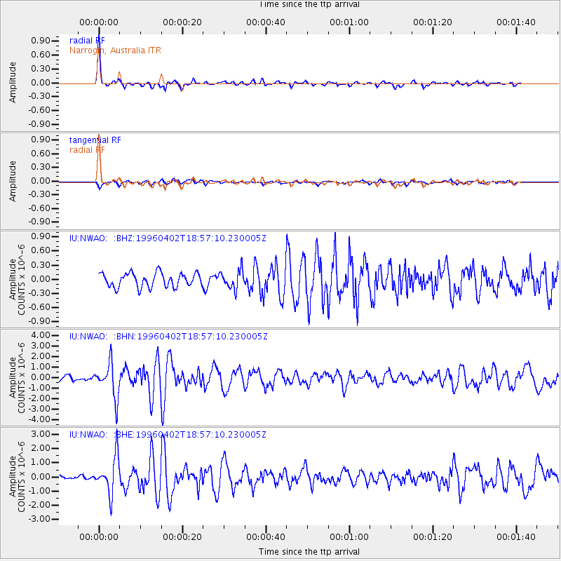
Signal To Noise
| Channel | StoN | STA | LTA |
| IU:NWAO: :BHN:19960402T18:57:10.230005Z | 7.708426 | 1.6609002E-6 | 2.1546555E-7 |
| IU:NWAO: :BHE:19960402T18:57:10.230005Z | 8.144579 | 1.3412587E-6 | 1.6468115E-7 |
| IU:NWAO: :BHZ:19960402T18:57:10.230005Z | 1.3438373 | 1.9790583E-7 | 1.4726919E-7 |
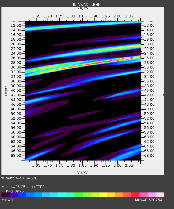
| Arrivals | |
| Ps | 4.6 SECOND |
| PpPs | 11 SECOND |
| PsPs/PpSs | 16 SECOND |

