
NWAO Narrogin, Australia - Earthquake Result Viewer
| ||||||||||||||||||
| ||||||||||||||||||
| ||||||||||||||||||
|
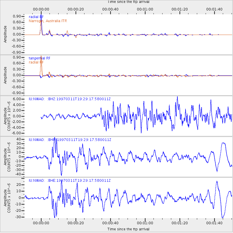
Signal To Noise
| Channel | StoN | STA | LTA |
| IU:NWAO: :BHN:19970311T19:29:17.580011Z | 7.118657 | 8.429387E-6 | 1.184126E-6 |
| IU:NWAO: :BHE:19970311T19:29:17.580011Z | 5.6196446 | 5.468147E-6 | 9.730413E-7 |
| IU:NWAO: :BHZ:19970311T19:29:17.580011Z | 1.9459939 | 9.985603E-7 | 5.1313634E-7 |
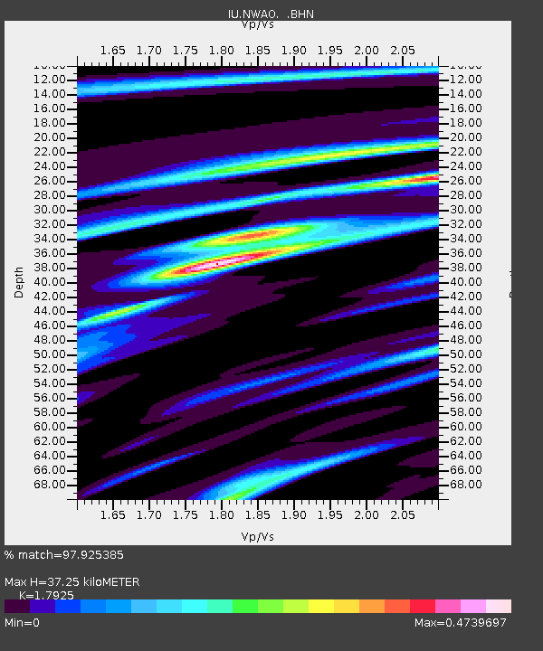
| Arrivals | |
| Ps | 4.9 SECOND |
| PpPs | 15 SECOND |
| PsPs/PpSs | 20 SECOND |

