You are here: Home > Network List > IU - Global Seismograph Network (GSN - IRIS/USGS) Stations List
> Station NWAO Narrogin, Australia > Earthquake Result Viewer
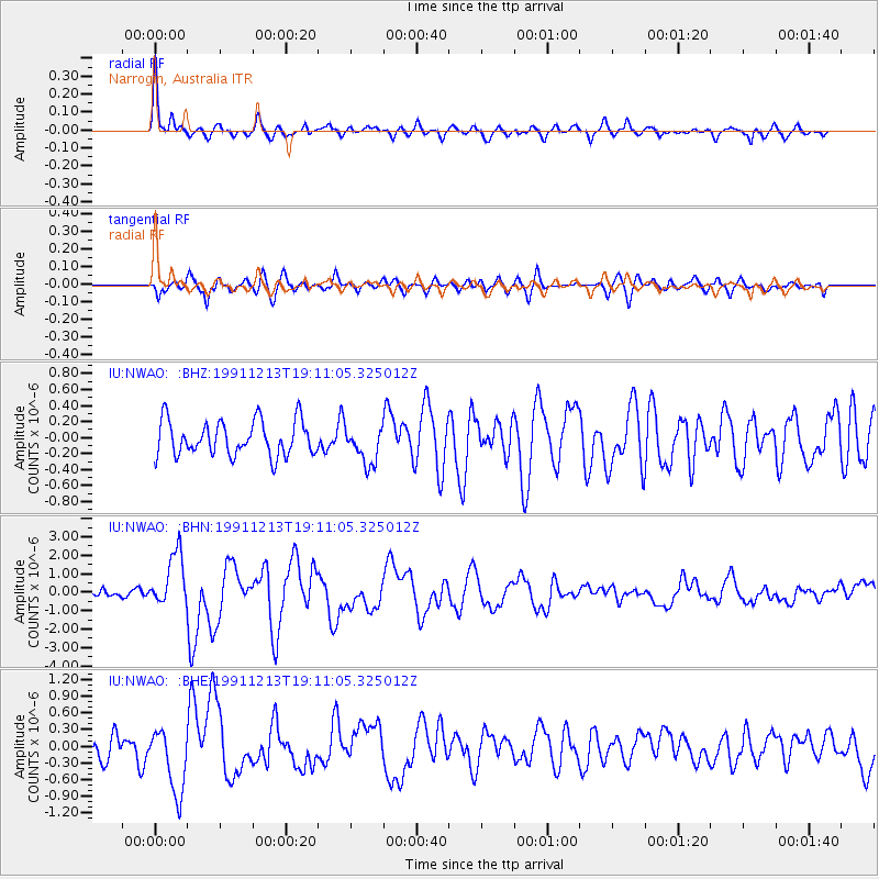
NWAO Narrogin, Australia - Earthquake Result Viewer
*The percent match for this event was below the threshold and hence no stack was calculated.
| Earthquake location: |
Kuril Islands |
| Earthquake latitude/longitude: |
45.6/151.7 |
| Earthquake time(UTC): |
1991/12/13 (347) 18:59:11 GMT |
| Earthquake Depth: |
52 km |
| Earthquake Magnitude: |
6.2 MB |
| Earthquake Catalog/Contributor: |
WHDF/NEIC |
|
| Network: |
IU Global Seismograph Network (GSN - IRIS/USGS) |
| Station: |
NWAO Narrogin, Australia |
| Lat/Lon: |
32.93 S/117.23 E |
| Elevation: |
265 m |
|
| Distance: |
84.1 deg |
| Az: |
208.599 deg |
| Baz: |
23.573 deg |
| Ray Param: |
$rayparam |
*The percent match for this event was below the threshold and hence was not used in the summary stack. |
|
| Radial Match: |
78.76131 % |
| Radial Bump: |
400 |
| Transverse Match: |
63.353024 % |
| Transverse Bump: |
400 |
| SOD ConfigId: |
4480 |
| Insert Time: |
2010-03-04 20:49:17.812 +0000 |
| GWidth: |
2.5 |
| Max Bumps: |
400 |
| Tol: |
0.001 |
|
Signal To Noise
| Channel | StoN | STA | LTA |
| IU:NWAO: :BHN:19911213T19:11:05.325012Z | 5.7770357 | 1.46232E-6 | 2.5312636E-7 |
| IU:NWAO: :BHE:19911213T19:11:05.325012Z | 2.172184 | 5.965428E-7 | 2.7462812E-7 |
| IU:NWAO: :BHZ:19911213T19:11:05.325012Z | 1.0658284 | 2.3262152E-7 | 2.1825417E-7 |
| Arrivals |
| Ps | |
| PpPs | |
| PsPs/PpSs | |


