You are here: Home > Network List > IU - Global Seismograph Network (GSN - IRIS/USGS) Stations List
> Station NWAO Narrogin, Australia > Earthquake Result Viewer
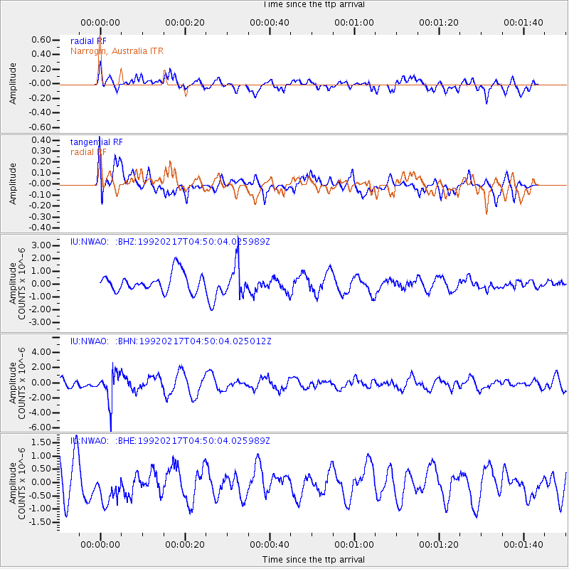
NWAO Narrogin, Australia - Earthquake Result Viewer
*The percent match for this event was below the threshold and hence no stack was calculated.
| Earthquake location: |
Southeast Of Loyalty Islands |
| Earthquake latitude/longitude: |
-21.6/170.4 |
| Earthquake time(UTC): |
1992/02/17 (048) 04:42:08 GMT |
| Earthquake Depth: |
137 km |
| Earthquake Magnitude: |
5.5 MB |
| Earthquake Catalog/Contributor: |
WHDF/NEIC |
|
| Network: |
IU Global Seismograph Network (GSN - IRIS/USGS) |
| Station: |
NWAO Narrogin, Australia |
| Lat/Lon: |
32.93 S/117.23 E |
| Elevation: |
265 m |
|
| Distance: |
48.2 deg |
| Az: |
244.659 deg |
| Baz: |
90.49 deg |
| Ray Param: |
$rayparam |
*The percent match for this event was below the threshold and hence was not used in the summary stack. |
|
| Radial Match: |
52.702637 % |
| Radial Bump: |
400 |
| Transverse Match: |
62.02092 % |
| Transverse Bump: |
400 |
| SOD ConfigId: |
4480 |
| Insert Time: |
2010-03-04 20:49:21.414 +0000 |
| GWidth: |
2.5 |
| Max Bumps: |
400 |
| Tol: |
0.001 |
|
Signal To Noise
| Channel | StoN | STA | LTA |
| IU:NWAO: :BHN:19920217T04:50:04.025012Z | 3.935135 | 1.9422841E-6 | 4.93575E-7 |
| IU:NWAO: :BHE:19920217T04:50:04.025989Z | 0.8952301 | 6.678629E-7 | 7.460237E-7 |
| IU:NWAO: :BHZ:19920217T04:50:04.025989Z | 1.7470934 | 1.230222E-6 | 7.0415354E-7 |
| Arrivals |
| Ps | |
| PpPs | |
| PsPs/PpSs | |


