You are here: Home > Network List > TA - USArray Transportable Network (new EarthScope stations) Stations List
> Station G03D McMinnville, OR, USA > Earthquake Result Viewer
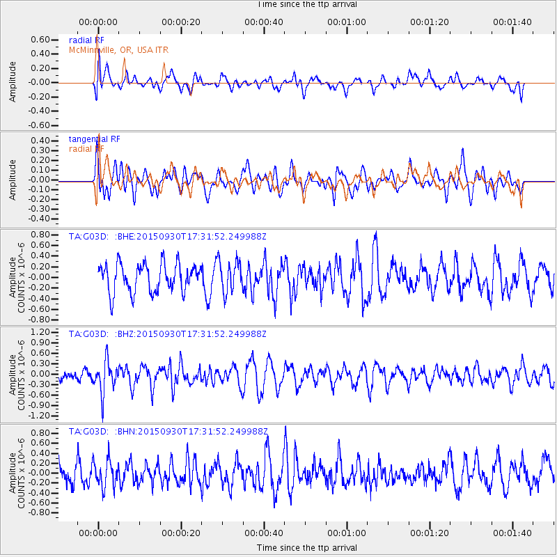
G03D McMinnville, OR, USA - Earthquake Result Viewer
*The percent match for this event was below the threshold and hence no stack was calculated.
| Earthquake location: |
Guerrero, Mexico |
| Earthquake latitude/longitude: |
18.1/-101.3 |
| Earthquake time(UTC): |
2015/09/30 (273) 17:25:56 GMT |
| Earthquake Depth: |
65 km |
| Earthquake Magnitude: |
5.5 MB |
| Earthquake Catalog/Contributor: |
NEIC PDE/NEIC COMCAT |
|
| Network: |
TA USArray Transportable Network (new EarthScope stations) |
| Station: |
G03D McMinnville, OR, USA |
| Lat/Lon: |
45.21 N/123.26 W |
| Elevation: |
222 m |
|
| Distance: |
32.7 deg |
| Az: |
330.647 deg |
| Baz: |
138.731 deg |
| Ray Param: |
$rayparam |
*The percent match for this event was below the threshold and hence was not used in the summary stack. |
|
| Radial Match: |
37.539562 % |
| Radial Bump: |
400 |
| Transverse Match: |
47.845142 % |
| Transverse Bump: |
400 |
| SOD ConfigId: |
7422571 |
| Insert Time: |
2019-04-21 01:25:58.160 +0000 |
| GWidth: |
2.5 |
| Max Bumps: |
400 |
| Tol: |
0.001 |
|
Signal To Noise
| Channel | StoN | STA | LTA |
| TA:G03D: :BHZ:20150930T17:31:52.249988Z | 2.5791295 | 4.6299263E-7 | 1.7951508E-7 |
| TA:G03D: :BHN:20150930T17:31:52.249988Z | 1.4025459 | 2.6268202E-7 | 1.8728942E-7 |
| TA:G03D: :BHE:20150930T17:31:52.249988Z | 1.0601081 | 2.8210255E-7 | 2.6610735E-7 |
| Arrivals |
| Ps | |
| PpPs | |
| PsPs/PpSs | |


