You are here: Home > Network List > TA - USArray Transportable Network (new EarthScope stations) Stations List
> Station R11A Troy Canyon, Currant, NV, USA > Earthquake Result Viewer
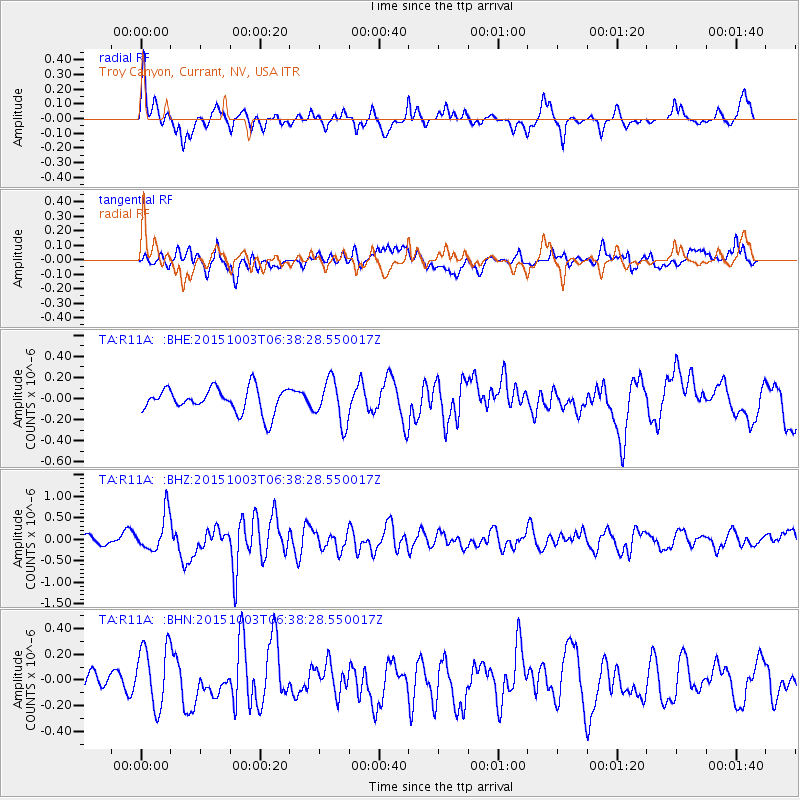
R11A Troy Canyon, Currant, NV, USA - Earthquake Result Viewer
*The percent match for this event was below the threshold and hence no stack was calculated.
| Earthquake location: |
Near Coast Of Central Chile |
| Earthquake latitude/longitude: |
-30.3/-71.6 |
| Earthquake time(UTC): |
2015/10/03 (276) 06:26:55 GMT |
| Earthquake Depth: |
40 km |
| Earthquake Magnitude: |
5.8 MWR |
| Earthquake Catalog/Contributor: |
NEIC PDE/NEIC COMCAT |
|
| Network: |
TA USArray Transportable Network (new EarthScope stations) |
| Station: |
R11A Troy Canyon, Currant, NV, USA |
| Lat/Lon: |
38.35 N/115.59 W |
| Elevation: |
1756 m |
|
| Distance: |
79.7 deg |
| Az: |
326.271 deg |
| Baz: |
142.36 deg |
| Ray Param: |
$rayparam |
*The percent match for this event was below the threshold and hence was not used in the summary stack. |
|
| Radial Match: |
65.49737 % |
| Radial Bump: |
317 |
| Transverse Match: |
62.01949 % |
| Transverse Bump: |
400 |
| SOD ConfigId: |
7422571 |
| Insert Time: |
2019-04-21 01:40:35.331 +0000 |
| GWidth: |
2.5 |
| Max Bumps: |
400 |
| Tol: |
0.001 |
|
Signal To Noise
| Channel | StoN | STA | LTA |
| TA:R11A: :BHZ:20151003T06:38:28.550017Z | 3.2631931 | 4.3137194E-7 | 1.3219321E-7 |
| TA:R11A: :BHN:20151003T06:38:28.550017Z | 2.5176814 | 2.4384133E-7 | 9.685155E-8 |
| TA:R11A: :BHE:20151003T06:38:28.550017Z | 1.7230465 | 1.9870411E-7 | 1.1532139E-7 |
| Arrivals |
| Ps | |
| PpPs | |
| PsPs/PpSs | |


