You are here: Home > Network List > CI - Caltech Regional Seismic Network Stations List
> Station GSC Goldstone, Goldstone Lake, CA, USA > Earthquake Result Viewer
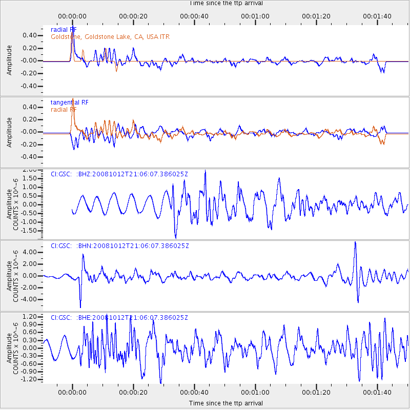
GSC Goldstone, Goldstone Lake, CA, USA - Earthquake Result Viewer
*The percent match for this event was below the threshold and hence no stack was calculated.
| Earthquake location: |
Southern Bolivia |
| Earthquake latitude/longitude: |
-20.1/-65.0 |
| Earthquake time(UTC): |
2008/10/12 (286) 20:55:41 GMT |
| Earthquake Depth: |
353 km |
| Earthquake Magnitude: |
6.0 MB, 6.2 MW, 6.2 MW |
| Earthquake Catalog/Contributor: |
WHDF/NEIC |
|
| Network: |
CI Caltech Regional Seismic Network |
| Station: |
GSC Goldstone, Goldstone Lake, CA, USA |
| Lat/Lon: |
35.30 N/116.81 W |
| Elevation: |
1000 m |
|
| Distance: |
73.8 deg |
| Az: |
317.97 deg |
| Baz: |
129.719 deg |
| Ray Param: |
$rayparam |
*The percent match for this event was below the threshold and hence was not used in the summary stack. |
|
| Radial Match: |
62.31564 % |
| Radial Bump: |
400 |
| Transverse Match: |
66.13577 % |
| Transverse Bump: |
400 |
| SOD ConfigId: |
2560 |
| Insert Time: |
2010-02-25 23:50:26.618 +0000 |
| GWidth: |
2.5 |
| Max Bumps: |
400 |
| Tol: |
0.001 |
|
Signal To Noise
| Channel | StoN | STA | LTA |
| CI:GSC: :BHN:20081012T21:06:07.386025Z | 10.971772 | 1.790481E-6 | 1.6318977E-7 |
| CI:GSC: :BHE:20081012T21:06:07.386025Z | 1.2794422 | 3.5610995E-7 | 2.783322E-7 |
| CI:GSC: :BHZ:20081012T21:06:07.386025Z | 2.1723905 | 8.367595E-7 | 3.8517913E-7 |
| Arrivals |
| Ps | |
| PpPs | |
| PsPs/PpSs | |


