You are here: Home > Network List > IU - Global Seismograph Network (GSN - IRIS/USGS) Stations List
> Station NWAO Narrogin, Australia > Earthquake Result Viewer
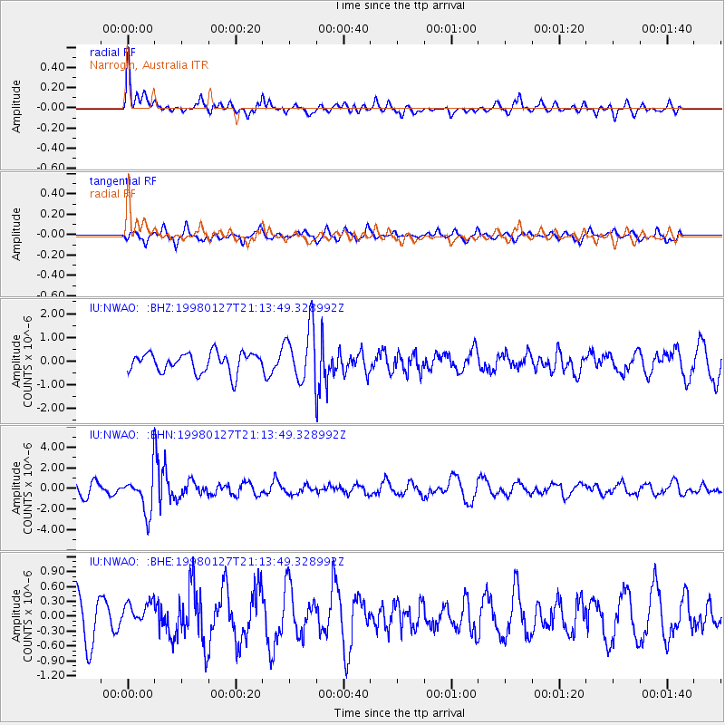
NWAO Narrogin, Australia - Earthquake Result Viewer
*The percent match for this event was below the threshold and hence no stack was calculated.
| Earthquake location: |
South Of Fiji Islands |
| Earthquake latitude/longitude: |
-22.4/179.0 |
| Earthquake time(UTC): |
1998/01/27 (027) 21:05:44 GMT |
| Earthquake Depth: |
610 km |
| Earthquake Magnitude: |
5.6 MB, 6.5 UNKNOWN, 6.4 MW |
| Earthquake Catalog/Contributor: |
WHDF/NEIC |
|
| Network: |
IU Global Seismograph Network (GSN - IRIS/USGS) |
| Station: |
NWAO Narrogin, Australia |
| Lat/Lon: |
32.93 S/117.23 E |
| Elevation: |
265 m |
|
| Distance: |
55.1 deg |
| Az: |
244.725 deg |
| Baz: |
95.759 deg |
| Ray Param: |
$rayparam |
*The percent match for this event was below the threshold and hence was not used in the summary stack. |
|
| Radial Match: |
67.73439 % |
| Radial Bump: |
355 |
| Transverse Match: |
63.57615 % |
| Transverse Bump: |
310 |
| SOD ConfigId: |
4480 |
| Insert Time: |
2010-03-04 20:50:50.726 +0000 |
| GWidth: |
2.5 |
| Max Bumps: |
400 |
| Tol: |
0.001 |
|
Signal To Noise
| Channel | StoN | STA | LTA |
| IU:NWAO: :BHN:19980127T21:13:49.328992Z | 3.5631442 | 1.9880986E-6 | 5.5796187E-7 |
| IU:NWAO: :BHE:19980127T21:13:49.328992Z | 0.52944446 | 2.461443E-7 | 4.6491056E-7 |
| IU:NWAO: :BHZ:19980127T21:13:49.328992Z | 2.8879652 | 1.1807192E-6 | 4.088412E-7 |
| Arrivals |
| Ps | |
| PpPs | |
| PsPs/PpSs | |


