You are here: Home > Network List > WY - Yellowstone Wyoming Seismic Network Stations List
> Station YHH Holmes Hill, YNP, WY, USA > Earthquake Result Viewer
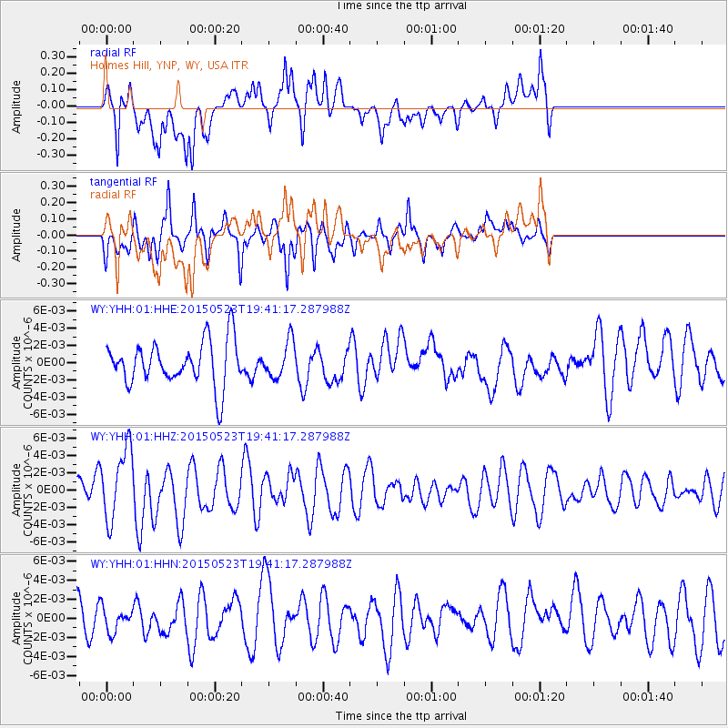
YHH Holmes Hill, YNP, WY, USA - Earthquake Result Viewer
*The percent match for this event was below the threshold and hence no stack was calculated.
| Earthquake location: |
New Britain Region, P.N.G. |
| Earthquake latitude/longitude: |
-4.8/152.7 |
| Earthquake time(UTC): |
2015/05/23 (143) 19:28:18 GMT |
| Earthquake Depth: |
51 km |
| Earthquake Magnitude: |
5.7 MB |
| Earthquake Catalog/Contributor: |
NEIC PDE/NEIC ALERT |
|
| Network: |
WY Yellowstone Wyoming Seismic Network |
| Station: |
YHH Holmes Hill, YNP, WY, USA |
| Lat/Lon: |
44.79 N/110.85 W |
| Elevation: |
2717 m |
|
| Distance: |
98.0 deg |
| Az: |
45.599 deg |
| Baz: |
271.12 deg |
| Ray Param: |
$rayparam |
*The percent match for this event was below the threshold and hence was not used in the summary stack. |
|
| Radial Match: |
63.8871 % |
| Radial Bump: |
400 |
| Transverse Match: |
70.038376 % |
| Transverse Bump: |
369 |
| SOD ConfigId: |
976571 |
| Insert Time: |
2015-06-06 20:01:09.479 +0000 |
| GWidth: |
2.5 |
| Max Bumps: |
400 |
| Tol: |
0.001 |
|
Signal To Noise
| Channel | StoN | STA | LTA |
| WY:YHH:01:HHZ:20150523T19:41:17.287988Z | 2.0295975 | 4.1376245E-9 | 2.0386428E-9 |
| WY:YHH:01:HHN:20150523T19:41:17.287988Z | 0.8522751 | 1.2824469E-9 | 1.5047336E-9 |
| WY:YHH:01:HHE:20150523T19:41:17.287988Z | 0.8305422 | 2.135813E-9 | 2.571589E-9 |
| Arrivals |
| Ps | |
| PpPs | |
| PsPs/PpSs | |


