You are here: Home > Network List > TA - USArray Transportable Network (new EarthScope stations) Stations List
> Station R11A Troy Canyon, Currant, NV, USA > Earthquake Result Viewer
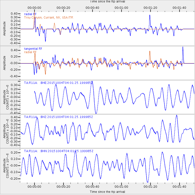
R11A Troy Canyon, Currant, NV, USA - Earthquake Result Viewer
*The percent match for this event was below the threshold and hence no stack was calculated.
| Earthquake location: |
Off Coast Of Central Chile |
| Earthquake latitude/longitude: |
-30.3/-72.1 |
| Earthquake time(UTC): |
2015/10/04 (277) 03:49:49 GMT |
| Earthquake Depth: |
4.9 km |
| Earthquake Magnitude: |
5.5 MWW, 5.3 MWR |
| Earthquake Catalog/Contributor: |
NEIC PDE/NEIC COMCAT |
|
| Network: |
TA USArray Transportable Network (new EarthScope stations) |
| Station: |
R11A Troy Canyon, Currant, NV, USA |
| Lat/Lon: |
38.35 N/115.59 W |
| Elevation: |
1756 m |
|
| Distance: |
79.4 deg |
| Az: |
326.611 deg |
| Baz: |
142.746 deg |
| Ray Param: |
$rayparam |
*The percent match for this event was below the threshold and hence was not used in the summary stack. |
|
| Radial Match: |
48.369385 % |
| Radial Bump: |
311 |
| Transverse Match: |
47.802597 % |
| Transverse Bump: |
396 |
| SOD ConfigId: |
7422571 |
| Insert Time: |
2019-04-21 01:48:07.669 +0000 |
| GWidth: |
2.5 |
| Max Bumps: |
400 |
| Tol: |
0.001 |
|
Signal To Noise
| Channel | StoN | STA | LTA |
| TA:R11A: :BHZ:20151004T04:01:25.199985Z | 2.852079 | 2.4144595E-7 | 8.465613E-8 |
| TA:R11A: :BHN:20151004T04:01:25.199985Z | 0.6324901 | 8.66636E-8 | 1.370197E-7 |
| TA:R11A: :BHE:20151004T04:01:25.199985Z | 0.45064095 | 7.744882E-8 | 1.718637E-7 |
| Arrivals |
| Ps | |
| PpPs | |
| PsPs/PpSs | |


