
SNZO South Karori, New Zealand - Earthquake Result Viewer
| ||||||||||||||||||
| ||||||||||||||||||
| ||||||||||||||||||
|
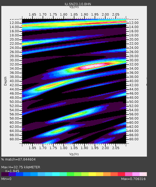
Signal To Noise
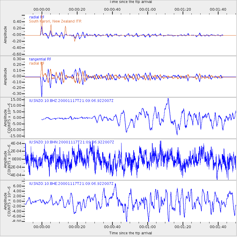
| Channel | StoN | STA | LTA |
| IU:SNZO:10:BHN:20001117T21:09:06.922007Z | 0.9345747 | 1.3963349E-10 | 1.4940858E-10 |
| IU:SNZO:10:BHE:20001117T21:09:06.922007Z | 0.6101504 | 5.2549115E-7 | 8.612485E-7 |
| IU:SNZO:10:BHZ:20001117T21:09:06.922007Z | 3.5092468 | 1.8386388E-6 | 5.2394114E-7 |
| Arrivals | |
| Ps | 5.1 SECOND |
| PpPs | 14 SECOND |
| PsPs/PpSs | 19 SECOND |

