
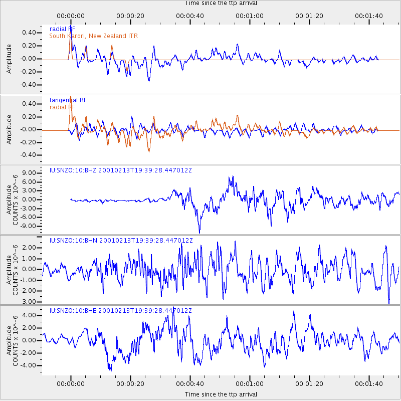
SNZO South Karori, New Zealand - Earthquake Result Viewer
| ||||||||||||||||||
| ||||||||||||||||||
| ||||||||||||||||||
|
Signal To Noise
| Channel | StoN | STA | LTA |
| IU:SNZO:10:BHN:20010213T19:39:28.447012Z | 1.4019008 | 5.6928616E-7 | 4.0608163E-7 |
| IU:SNZO:10:BHE:20010213T19:39:28.447012Z | 1.0868762 | 9.735547E-7 | 8.957366E-7 |
| IU:SNZO:10:BHZ:20010213T19:39:28.447012Z | 6.7607546 | 1.4541398E-6 | 2.1508542E-7 |
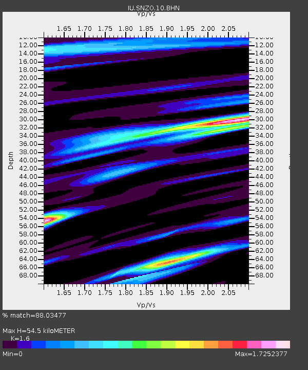
| Arrivals | |
| Ps | 5.3 SECOND |
| PpPs | 21 SECOND |
| PsPs/PpSs | 26 SECOND |

