
SNZO South Karori, New Zealand - Earthquake Result Viewer
| ||||||||||||||||||
| ||||||||||||||||||
| ||||||||||||||||||
|
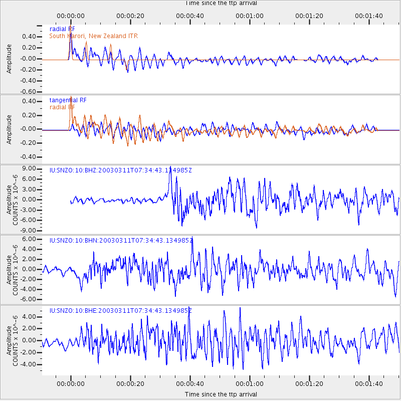
Signal To Noise
| Channel | StoN | STA | LTA |
| IU:SNZO:10:BHN:20030311T07:34:43.134985Z | 3.493096 | 1.5683328E-6 | 4.4898073E-7 |
| IU:SNZO:10:BHE:20030311T07:34:43.134985Z | 1.3850968 | 7.9848735E-7 | 5.7648487E-7 |
| IU:SNZO:10:BHZ:20030311T07:34:43.134985Z | 7.379843 | 3.4712778E-6 | 4.7037284E-7 |
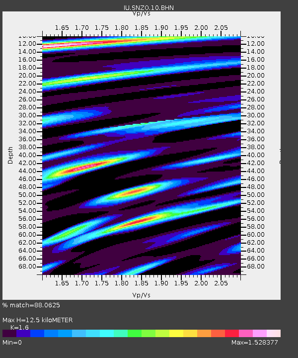
| Arrivals | |
| Ps | 1.3 SECOND |
| PpPs | 4.7 SECOND |
| PsPs/PpSs | 5.9 SECOND |

