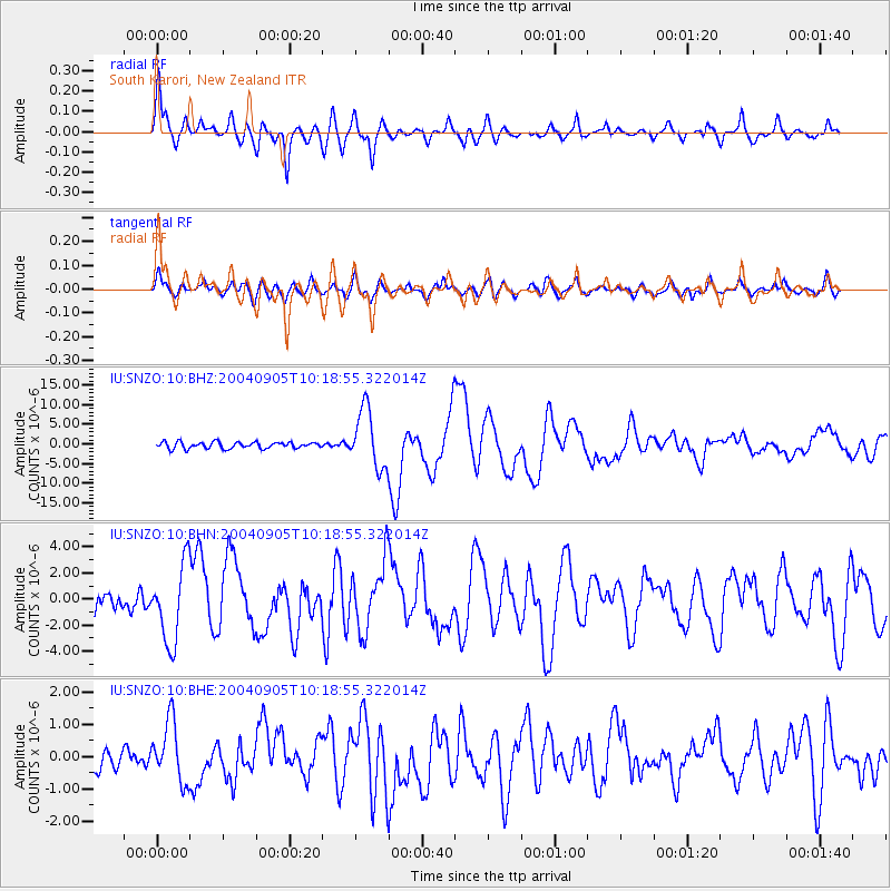
SNZO South Karori, New Zealand - Earthquake Result Viewer
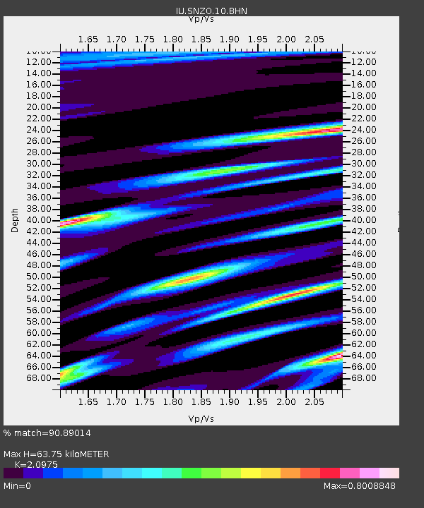
Earthquake location: Near S. Coast Of Western Honshu
Earthquake latitude/longitude: 33.1/136.6
Earthquake time(UTC): 2004/09/05 (249) 10:07:07 GMT
Earthquake Depth: 14 km
Earthquake Magnitude: 6.7 MB, 7.0 MS, 7.2 MW, 7.0 MW
Earthquake Catalog/Contributor: WHDF/NEIC
Network: IU Global Seismograph Network (GSN - IRIS/USGS)
Station: SNZO South Karori, New Zealand
Lat/Lon: 41.31 S/174.70 E
Elevation: 62 m
Distance: 81.9 deg
Az: 152.007 deg
Baz: 328.456 deg
Ray Param: 0.047247376
Estimated Moho Depth: 63.75 km
Estimated Crust Vp/Vs: 2.10
Assumed Crust Vp: 6.461 km/s
Estimated Crust Vs: 3.081 km/s
Estimated Crust Poisson's Ratio: 0.35
Radial Match: 90.89014 %
Radial Bump: 400
Transverse Match: 82.14801 %
Transverse Bump: 400
SOD ConfigId: 2459
Insert Time: 2010-03-04 20:53:29.115 +0000
GWidth: 2.5
Max Bumps: 400
Tol: 0.001

Signal To Noise

ChannelStoNSTALTA
IU:SNZO:10:BHN:20040905T10:18:55.322014Z4.8881482.9647072E-66.0650933E-7
IU:SNZO:10:BHE:20040905T10:18:55.322014Z2.92278159.255702E-73.1667443E-7
IU:SNZO:10:BHZ:20040905T10:18:55.322014Z9.1607537.4110017E-68.0899474E-7
Arrivals
Ps11 SECOND
PpPs30 SECOND
PsPs/PpSs41 SECOND