
SNZO South Karori, New Zealand - Earthquake Result Viewer
| ||||||||||||||||||
| ||||||||||||||||||
| ||||||||||||||||||
|
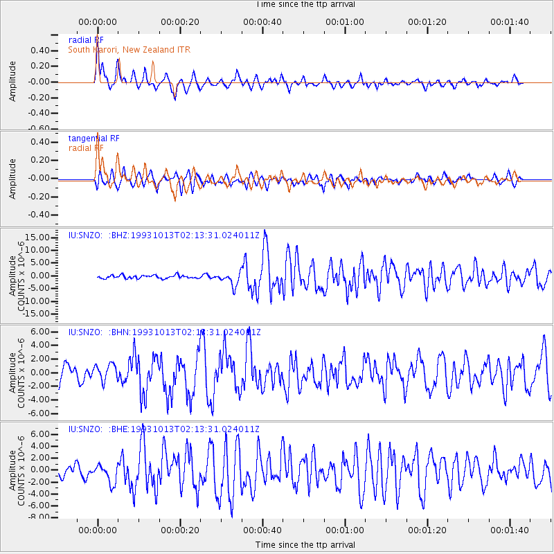
Signal To Noise
| Channel | StoN | STA | LTA |
| IU:SNZO: :BHN:19931013T02:13:31.024011Z | 1.1505284 | 1.2135713E-6 | 1.0547947E-6 |
| IU:SNZO: :BHE:19931013T02:13:31.024011Z | 1.7325612 | 1.5863072E-6 | 9.1558513E-7 |
| IU:SNZO: :BHZ:19931013T02:13:31.024011Z | 4.394296 | 2.6675257E-6 | 6.0704275E-7 |
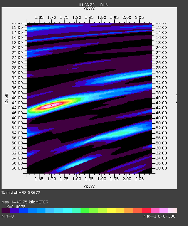
| Arrivals | |
| Ps | 4.9 SECOND |
| PpPs | 17 SECOND |
| PsPs/PpSs | 22 SECOND |

