
SNZO South Karori, New Zealand - Earthquake Result Viewer
| ||||||||||||||||||
| ||||||||||||||||||
| ||||||||||||||||||
|
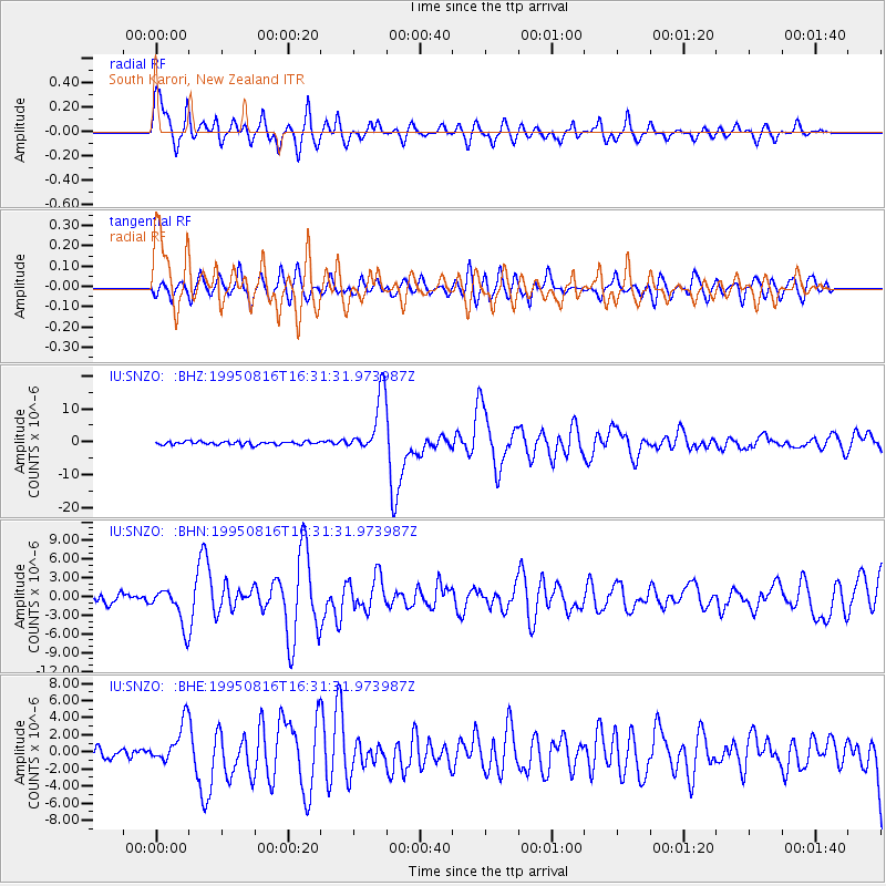
Signal To Noise
| Channel | StoN | STA | LTA |
| IU:SNZO: :BHN:19950816T16:31:31.973987Z | 4.9242764 | 3.0258243E-6 | 6.144709E-7 |
| IU:SNZO: :BHE:19950816T16:31:31.973987Z | 3.9058154 | 2.3978128E-6 | 6.1390836E-7 |
| IU:SNZO: :BHZ:19950816T16:31:31.973987Z | 18.51401 | 9.005228E-6 | 4.864007E-7 |
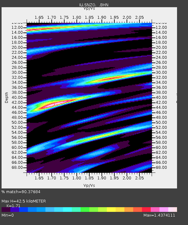
| Arrivals | |
| Ps | 5.0 SECOND |
| PpPs | 17 SECOND |
| PsPs/PpSs | 22 SECOND |

