SNZO South Karori, New Zealand - Earthquake Result Viewer
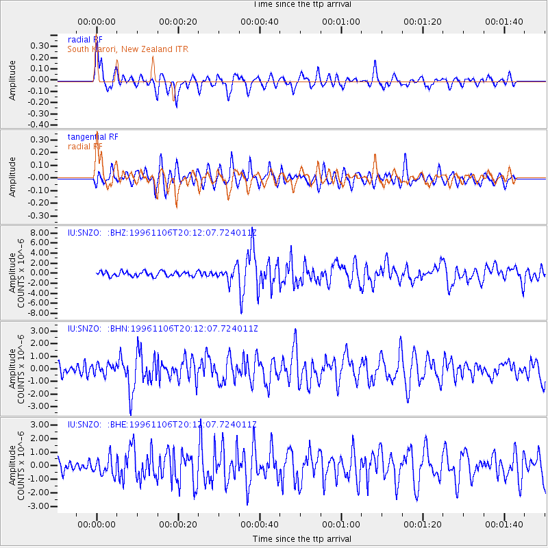
Earthquake location: Bonin Islands, Japan Region
Earthquake latitude/longitude: 28.0/143.5
Earthquake time(UTC): 1996/11/06 (311) 20:00:58 GMT
Earthquake Depth: 9.0 km
Earthquake Magnitude: 6.4 MB, 6.5 MS, 6.6 UNKNOWN, 6.4 ME
Earthquake Catalog/Contributor: WHDF/NEIC
Network: IU Global Seismograph Network (GSN - IRIS/USGS)
Station: SNZO South Karori, New Zealand
Lat/Lon: 41.31 S/174.70 E
Elevation: 62 m
Distance: 74.8 deg
Az: 156.166 deg
Baz: 331.686 deg
Ray Param: 0.052119754
Estimated Moho Depth: 12.5 km
Estimated Crust Vp/Vs: 1.62
Assumed Crust Vp: 6.461 km/s
Estimated Crust Vs: 3.982 km/s
Estimated Crust Poisson's Ratio: 0.19
Radial Match: 83.1142 %
Radial Bump: 400
Transverse Match: 66.03367 %
Transverse Bump: 400
SOD ConfigId: 6273
Insert Time: 2010-03-04 20:54:19.018 +0000
GWidth: 2.5
Max Bumps: 400
Tol: 0.001

Signal To Noise

ChannelStoNSTALTA
IU:SNZO: :BHN:19961106T20:12:07.724011Z0.80136124.1114004E-75.130521E-7
IU:SNZO: :BHE:19961106T20:12:07.724011Z1.17866446.3704755E-75.404825E-7
IU:SNZO: :BHZ:19961106T20:12:07.724011Z2.85055521.3429786E-64.711288E-7
Arrivals
Ps1.2 SECOND
PpPs4.9 SECOND
PsPs/PpSs6.1 SECOND