
SNZO South Karori, New Zealand - Earthquake Result Viewer
| ||||||||||||||||||
| ||||||||||||||||||
| ||||||||||||||||||
|
Signal To Noise
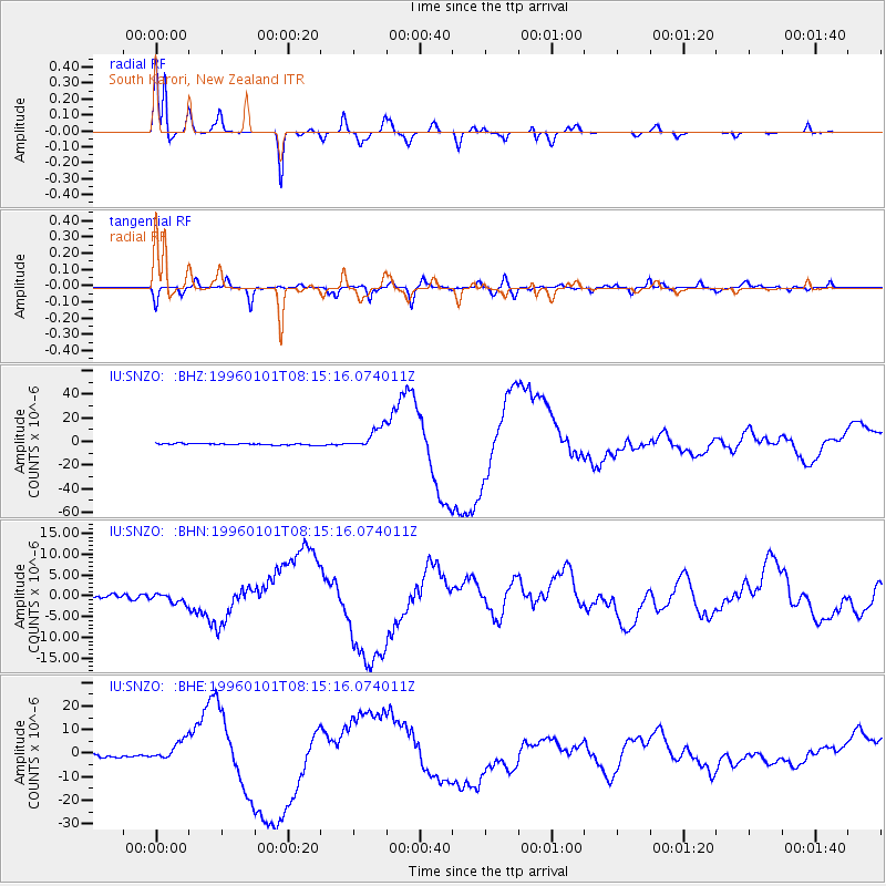
| Channel | StoN | STA | LTA |
| IU:SNZO: :BHN:19960101T08:15:16.074011Z | 1.8401477 | 1.0985219E-6 | 5.9697487E-7 |
| IU:SNZO: :BHE:19960101T08:15:16.074011Z | 6.948358 | 4.2672305E-6 | 6.141351E-7 |
| IU:SNZO: :BHZ:19960101T08:15:16.074011Z | 16.041616 | 9.33041E-6 | 5.8163783E-7 |
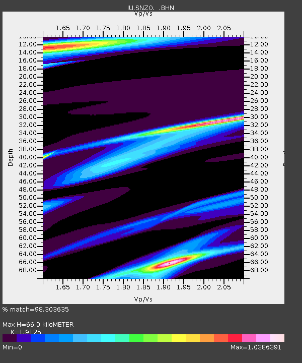
| Arrivals | |
| Ps | 9.7 SECOND |
| PpPs | 29 SECOND |
| PsPs/PpSs | 38 SECOND |

