
SNZO South Karori, New Zealand - Earthquake Result Viewer
| ||||||||||||||||||
| ||||||||||||||||||
| ||||||||||||||||||
|
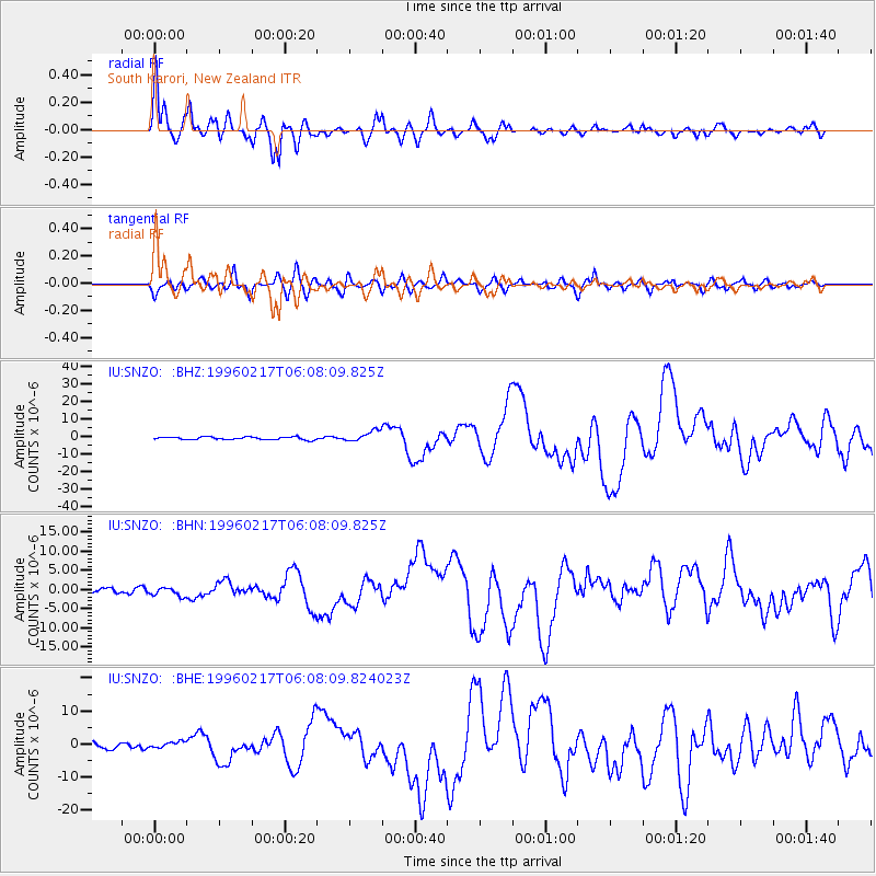
Signal To Noise
| Channel | StoN | STA | LTA |
| IU:SNZO: :BHN:19960217T06:08:09.825Z | 1.7355932 | 1.0832907E-6 | 6.241616E-7 |
| IU:SNZO: :BHE:19960217T06:08:09.824023Z | 1.5320774 | 1.0380463E-6 | 6.775417E-7 |
| IU:SNZO: :BHZ:19960217T06:08:09.825Z | 3.8681064 | 3.0075635E-6 | 7.7752867E-7 |
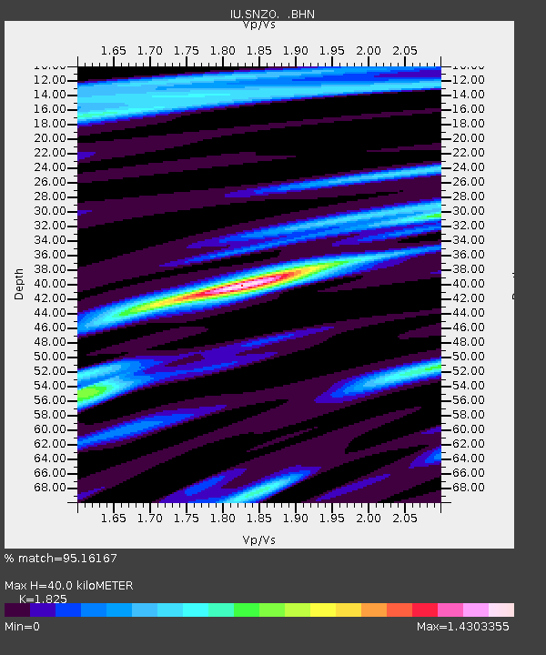
| Arrivals | |
| Ps | 5.4 SECOND |
| PpPs | 17 SECOND |
| PsPs/PpSs | 22 SECOND |

