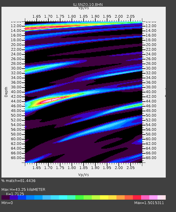
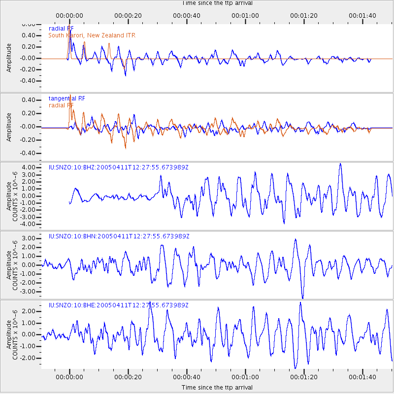
SNZO South Karori, New Zealand - Earthquake Result Viewer

Earthquake location: Near N Coast Of New Guinea, P.N.G.
Earthquake latitude/longitude: -3.5/145.9
Earthquake time(UTC): 2005/04/11 (101) 12:20:05 GMT
Earthquake Depth: 11 km
Earthquake Magnitude: 5.9 MB, 6.7 MS, 6.7 MW, 6.5 MW
Earthquake Catalog/Contributor: WHDF/NEIC
Network: IU Global Seismograph Network (GSN - IRIS/USGS)
Station: SNZO South Karori, New Zealand
Lat/Lon: 41.31 S/174.70 E
Elevation: 62 m
Distance: 45.7 deg
Az: 149.522 deg
Baz: 317.775 deg
Ray Param: 0.07111527
Estimated Moho Depth: 43.25 km
Estimated Crust Vp/Vs: 1.71
Assumed Crust Vp: 6.461 km/s
Estimated Crust Vs: 3.773 km/s
Estimated Crust Poisson's Ratio: 0.24
Radial Match: 81.4436 %
Radial Bump: 390
Transverse Match: 55.59209 %
Transverse Bump: 400
SOD ConfigId: 2459
Insert Time: 2010-03-04 20:54:31.967 +0000
GWidth: 2.5
Max Bumps: 400
Tol: 0.001

Signal To Noise

ChannelStoNSTALTA
IU:SNZO:10:BHN:20050411T12:27:55.673989Z1.33644757.675688E-75.7433516E-7
IU:SNZO:10:BHE:20050411T12:27:55.673989Z1.51807015.6252793E-73.7055466E-7
IU:SNZO:10:BHZ:20050411T12:27:55.673989Z3.13323931.3149017E-64.196621E-7
Arrivals
Ps5.1 SECOND
PpPs17 SECOND
PsPs/PpSs22 SECOND