You are here: Home > Network List > TA - USArray Transportable Network (new EarthScope stations) Stations List
> Station O03E Paynes Creek, CA, USA > Earthquake Result Viewer
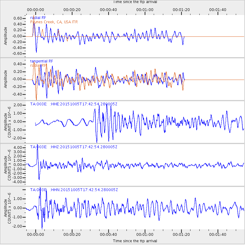
O03E Paynes Creek, CA, USA - Earthquake Result Viewer
*The percent match for this event was below the threshold and hence no stack was calculated.
| Earthquake location: |
Andreanof Islands, Aleutian Is. |
| Earthquake latitude/longitude: |
51.9/-179.3 |
| Earthquake time(UTC): |
2015/10/05 (278) 17:35:55 GMT |
| Earthquake Depth: |
89 km |
| Earthquake Magnitude: |
5.7 MB |
| Earthquake Catalog/Contributor: |
NEIC PDE/NEIC ALERT |
|
| Network: |
TA USArray Transportable Network (new EarthScope stations) |
| Station: |
O03E Paynes Creek, CA, USA |
| Lat/Lon: |
40.29 N/121.80 W |
| Elevation: |
967 m |
|
| Distance: |
40.5 deg |
| Az: |
83.236 deg |
| Baz: |
306.449 deg |
| Ray Param: |
$rayparam |
*The percent match for this event was below the threshold and hence was not used in the summary stack. |
|
| Radial Match: |
73.66321 % |
| Radial Bump: |
304 |
| Transverse Match: |
67.58517 % |
| Transverse Bump: |
336 |
| SOD ConfigId: |
7422571 |
| Insert Time: |
2019-04-21 02:11:19.025 +0000 |
| GWidth: |
2.5 |
| Max Bumps: |
400 |
| Tol: |
0.001 |
|
Signal To Noise
| Channel | StoN | STA | LTA |
| TA:O03E: :HHZ:20151005T17:42:54.280005Z | 12.389002 | 1.65556E-6 | 1.3363143E-7 |
| TA:O03E: :HHN:20151005T17:42:54.280005Z | 3.6733787 | 9.07796E-7 | 2.4712836E-7 |
| TA:O03E: :HHE:20151005T17:42:54.280005Z | 4.543256 | 1.0852688E-6 | 2.388747E-7 |
| Arrivals |
| Ps | |
| PpPs | |
| PsPs/PpSs | |


