You are here: Home > Network List > UW - Pacific Northwest Regional Seismic Network Stations List
> Station LEBA Lebam, WA, USA > Earthquake Result Viewer
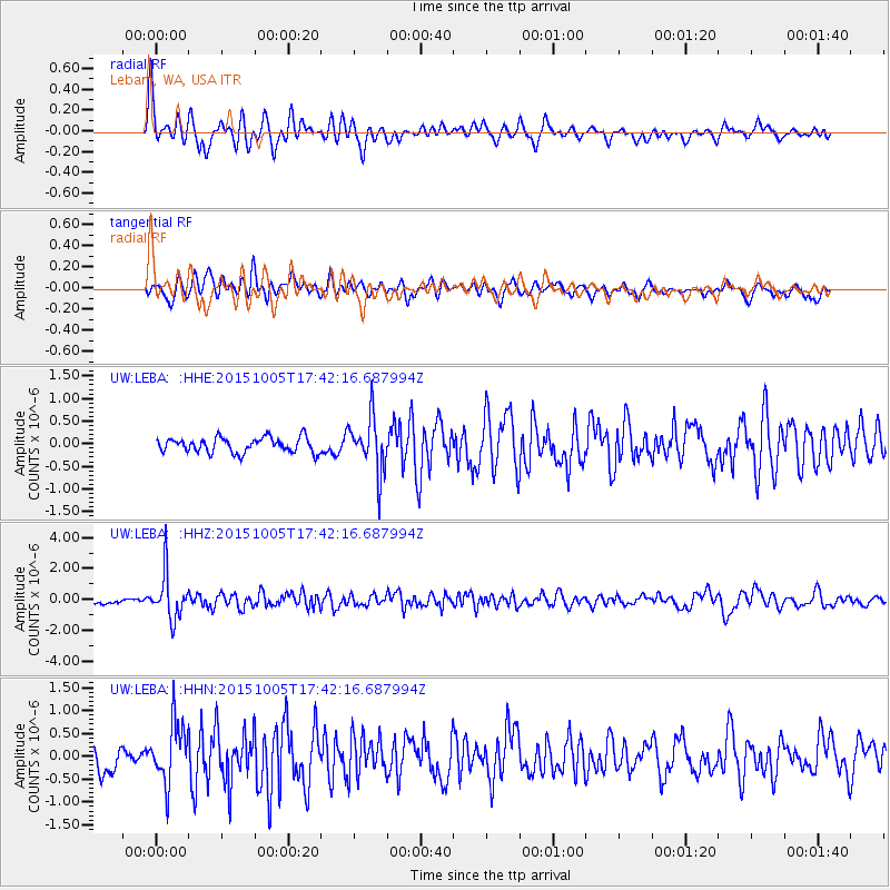
LEBA Lebam, WA, USA - Earthquake Result Viewer
*The percent match for this event was below the threshold and hence no stack was calculated.
| Earthquake location: |
Andreanof Islands, Aleutian Is. |
| Earthquake latitude/longitude: |
51.9/-179.3 |
| Earthquake time(UTC): |
2015/10/05 (278) 17:35:55 GMT |
| Earthquake Depth: |
89 km |
| Earthquake Magnitude: |
5.7 MB |
| Earthquake Catalog/Contributor: |
NEIC PDE/NEIC ALERT |
|
| Network: |
UW Pacific Northwest Regional Seismic Network |
| Station: |
LEBA Lebam, WA, USA |
| Lat/Lon: |
46.55 N/123.56 W |
| Elevation: |
73 m |
|
| Distance: |
36.0 deg |
| Az: |
75.898 deg |
| Baz: |
299.472 deg |
| Ray Param: |
$rayparam |
*The percent match for this event was below the threshold and hence was not used in the summary stack. |
|
| Radial Match: |
68.55854 % |
| Radial Bump: |
400 |
| Transverse Match: |
62.859108 % |
| Transverse Bump: |
400 |
| SOD ConfigId: |
7422571 |
| Insert Time: |
2019-04-21 02:12:43.764 +0000 |
| GWidth: |
2.5 |
| Max Bumps: |
400 |
| Tol: |
0.001 |
|
Signal To Noise
| Channel | StoN | STA | LTA |
| UW:LEBA: :HHZ:20151005T17:42:16.687994Z | 10.035552 | 1.4386335E-6 | 1.433537E-7 |
| UW:LEBA: :HHN:20151005T17:42:16.687994Z | 2.7123408 | 6.5585454E-7 | 2.418039E-7 |
| UW:LEBA: :HHE:20151005T17:42:16.687994Z | 3.612134 | 6.0150745E-7 | 1.6652412E-7 |
| Arrivals |
| Ps | |
| PpPs | |
| PsPs/PpSs | |


