You are here: Home > Network List > UW - Pacific Northwest Regional Seismic Network Stations List
> Station MRBL Marblemount, WA, USA > Earthquake Result Viewer
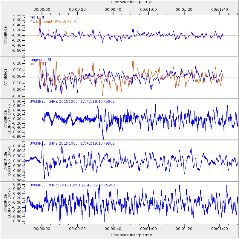
MRBL Marblemount, WA, USA - Earthquake Result Viewer
*The percent match for this event was below the threshold and hence no stack was calculated.
| Earthquake location: |
Andreanof Islands, Aleutian Is. |
| Earthquake latitude/longitude: |
51.9/-179.3 |
| Earthquake time(UTC): |
2015/10/05 (278) 17:35:55 GMT |
| Earthquake Depth: |
89 km |
| Earthquake Magnitude: |
5.7 MB |
| Earthquake Catalog/Contributor: |
NEIC PDE/NEIC ALERT |
|
| Network: |
UW Pacific Northwest Regional Seismic Network |
| Station: |
MRBL Marblemount, WA, USA |
| Lat/Lon: |
48.52 N/121.48 W |
| Elevation: |
75 m |
|
| Distance: |
36.3 deg |
| Az: |
71.819 deg |
| Baz: |
297.709 deg |
| Ray Param: |
$rayparam |
*The percent match for this event was below the threshold and hence was not used in the summary stack. |
|
| Radial Match: |
61.39174 % |
| Radial Bump: |
400 |
| Transverse Match: |
63.988224 % |
| Transverse Bump: |
400 |
| SOD ConfigId: |
7422571 |
| Insert Time: |
2019-04-21 02:12:46.721 +0000 |
| GWidth: |
2.5 |
| Max Bumps: |
400 |
| Tol: |
0.001 |
|
Signal To Noise
| Channel | StoN | STA | LTA |
| UW:MRBL: :HHZ:20151005T17:42:19.157996Z | 3.779308 | 5.379951E-7 | 1.423528E-7 |
| UW:MRBL: :HHN:20151005T17:42:19.157996Z | 1.1922759 | 2.078879E-7 | 1.7436224E-7 |
| UW:MRBL: :HHE:20151005T17:42:19.157996Z | 2.915334 | 3.8301488E-7 | 1.3137941E-7 |
| Arrivals |
| Ps | |
| PpPs | |
| PsPs/PpSs | |


