You are here: Home > Network List > US - United States National Seismic Network Stations List
> Station MSO Missoula, Montana, USA > Earthquake Result Viewer
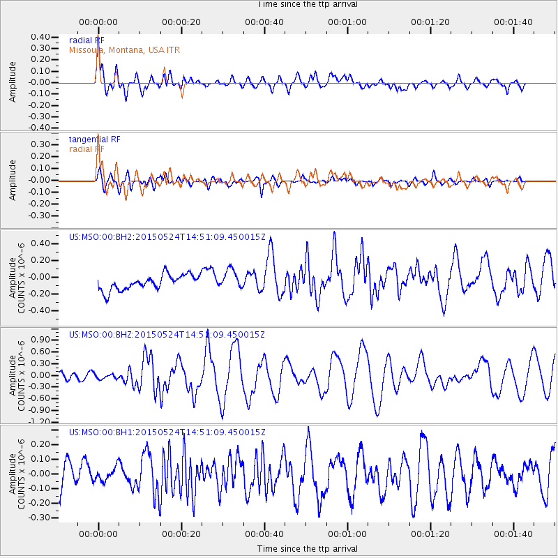
MSO Missoula, Montana, USA - Earthquake Result Viewer
*The percent match for this event was below the threshold and hence no stack was calculated.
| Earthquake location: |
Tonga Islands |
| Earthquake latitude/longitude: |
-19.3/-175.9 |
| Earthquake time(UTC): |
2015/05/24 (144) 14:39:02 GMT |
| Earthquake Depth: |
35 km |
| Earthquake Magnitude: |
5.7 MB |
| Earthquake Catalog/Contributor: |
NEIC PDE/NEIC COMCAT |
|
| Network: |
US United States National Seismic Network |
| Station: |
MSO Missoula, Montana, USA |
| Lat/Lon: |
46.83 N/113.94 W |
| Elevation: |
1264 m |
|
| Distance: |
86.3 deg |
| Az: |
37.413 deg |
| Baz: |
236.679 deg |
| Ray Param: |
$rayparam |
*The percent match for this event was below the threshold and hence was not used in the summary stack. |
|
| Radial Match: |
78.23366 % |
| Radial Bump: |
400 |
| Transverse Match: |
74.078224 % |
| Transverse Bump: |
400 |
| SOD ConfigId: |
976571 |
| Insert Time: |
2015-06-07 15:11:17.549 +0000 |
| GWidth: |
2.5 |
| Max Bumps: |
400 |
| Tol: |
0.001 |
|
Signal To Noise
| Channel | StoN | STA | LTA |
| US:MSO:00:BHZ:20150524T14:51:09.450015Z | 0.9479105 | 5.491662E-8 | 5.7934393E-8 |
| US:MSO:00:BH1:20150524T14:51:09.450015Z | 0.6104053 | 5.336961E-8 | 8.7433065E-8 |
| US:MSO:00:BH2:20150524T14:51:09.450015Z | 1.2763945 | 1.1350325E-7 | 8.89249E-8 |
| Arrivals |
| Ps | |
| PpPs | |
| PsPs/PpSs | |


