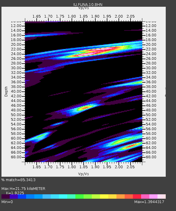
FUNA Funafuti, Tuvalu - Earthquake Result Viewer
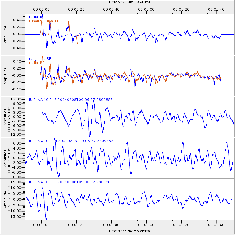
Earthquake location: Irian Jaya Region, Indonesia
Earthquake latitude/longitude: -3.7/135.3
Earthquake time(UTC): 2004/02/08 (039) 08:58:51 GMT
Earthquake Depth: 26 km
Earthquake Magnitude: 5.7 MB, 6.9 MS, 6.7 MW, 6.5 MW
Earthquake Catalog/Contributor: WHDF/NEIC
Network: IU Global Seismograph Network (GSN - IRIS/USGS)
Station: FUNA Funafuti, Tuvalu
Lat/Lon: 8.53 N/179.20 E
Elevation: 0.0 m
Distance: 45.4 deg
Az: 74.323 deg
Baz: 256.279 deg
Ray Param: 0.07126909
Estimated Moho Depth: 21.75 km
Estimated Crust Vp/Vs: 1.92
Assumed Crust Vp: 4.24 km/s
Estimated Crust Vs: 2.205 km/s
Estimated Crust Poisson's Ratio: 0.31
Radial Match: 85.3413 %
Radial Bump: 400
Transverse Match: 79.35895 %
Transverse Bump: 400
SOD ConfigId: 2459
Insert Time: 2010-03-04 20:55:33.552 +0000
GWidth: 2.5
Max Bumps: 400
Tol: 0.001

Signal To Noise

ChannelStoNSTALTA
IU:FUNA:10:BHN:20040208T09:06:37.280988Z1.78928042.2701936E-61.2687746E-6
IU:FUNA:10:BHE:20040208T09:06:37.280988Z4.98939379.15041E-61.8339723E-6
IU:FUNA:10:BHZ:20040208T09:06:37.280988Z1.78609066.0377215E-63.3804117E-6
Arrivals
Ps4.8 SECOND
PpPs15 SECOND
PsPs/PpSs19 SECOND