You are here: Home > Network List > TA - USArray Transportable Network (new EarthScope stations) Stations List
> Station X43A Marvell, AR, USA > Earthquake Result Viewer
X43A Marvell, AR, USA - Earthquake Result Viewer
*The percent match for this event was below the threshold and hence no stack was calculated.
| Earthquake location: |
Near Coast Of Central Chile |
| Earthquake latitude/longitude: |
-31.7/-71.7 |
| Earthquake time(UTC): |
2015/10/09 (282) 18:27:36 GMT |
| Earthquake Depth: |
35 km |
| Earthquake Magnitude: |
5.5 MWW, 5.4 MWR, 5.4 MWB |
| Earthquake Catalog/Contributor: |
NEIC PDE/NEIC COMCAT |
|
| Network: |
TA USArray Transportable Network (new EarthScope stations) |
| Station: |
X43A Marvell, AR, USA |
| Lat/Lon: |
34.52 N/90.88 W |
| Elevation: |
53 m |
|
| Distance: |
68.3 deg |
| Az: |
343.058 deg |
| Baz: |
162.5 deg |
| Ray Param: |
$rayparam |
*The percent match for this event was below the threshold and hence was not used in the summary stack. |
|
| Radial Match: |
64.929146 % |
| Radial Bump: |
400 |
| Transverse Match: |
85.08471 % |
| Transverse Bump: |
282 |
| SOD ConfigId: |
7422571 |
| Insert Time: |
2019-04-21 02:20:51.686 +0000 |
| GWidth: |
2.5 |
| Max Bumps: |
400 |
| Tol: |
0.001 |
|
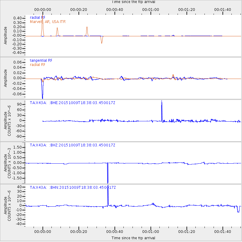
Signal To Noise
| Channel | StoN | STA | LTA |
| TA:X43A: :BHZ:20151009T18:38:03.450017Z | 0.397115 | 7.85692E-6 | 1.9784999E-5 |
| TA:X43A: :BHN:20151009T18:38:03.450017Z | 1.5583194 | 1.1665264E-6 | 7.485798E-7 |
| TA:X43A: :BHE:20151009T18:38:03.450017Z | 3.4549906 | 5.5776263E-6 | 1.614368E-6 |
| Arrivals |
| Ps | |
| PpPs | |
| PsPs/PpSs | |


