You are here: Home > Network List > US - United States National Seismic Network Stations List
> Station WMOK Wichita Mountains, Oklahoma, USA > Earthquake Result Viewer
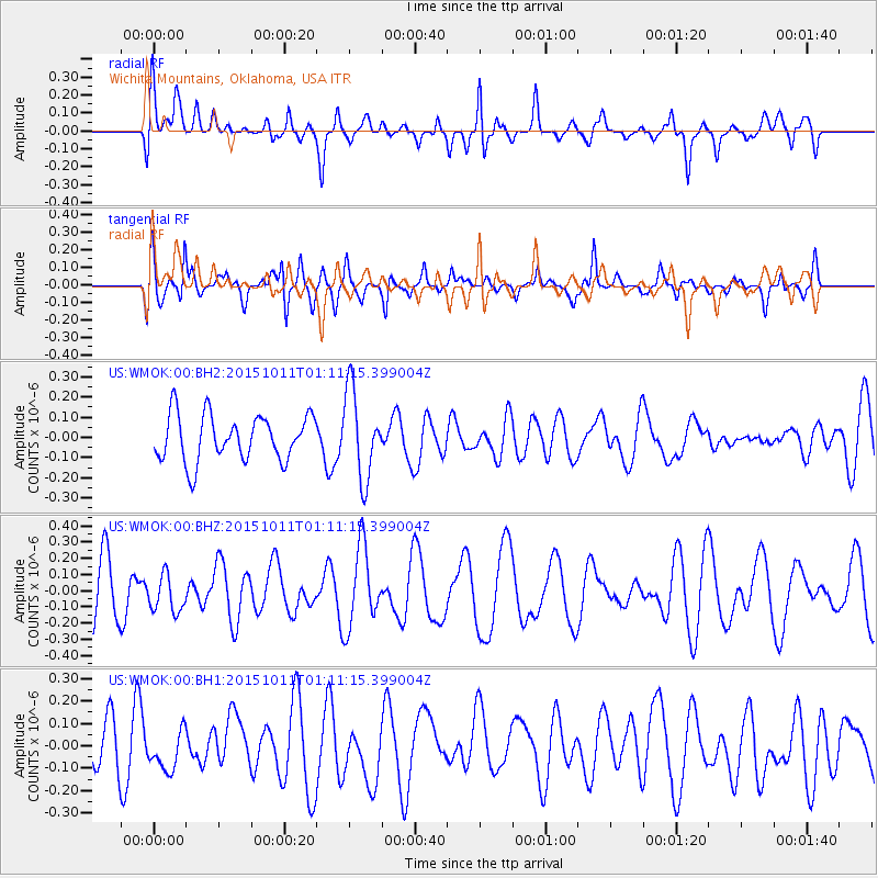
WMOK Wichita Mountains, Oklahoma, USA - Earthquake Result Viewer
*The percent match for this event was below the threshold and hence no stack was calculated.
| Earthquake location: |
Pacific-Antarctic Ridge |
| Earthquake latitude/longitude: |
-54.6/-135.8 |
| Earthquake time(UTC): |
2015/10/11 (284) 00:58:27 GMT |
| Earthquake Depth: |
10 km |
| Earthquake Magnitude: |
5.5 MB |
| Earthquake Catalog/Contributor: |
NEIC PDE/NEIC COMCAT |
|
| Network: |
US United States National Seismic Network |
| Station: |
WMOK Wichita Mountains, Oklahoma, USA |
| Lat/Lon: |
34.74 N/98.78 W |
| Elevation: |
486 m |
|
| Distance: |
94.5 deg |
| Az: |
29.834 deg |
| Baz: |
200.591 deg |
| Ray Param: |
$rayparam |
*The percent match for this event was below the threshold and hence was not used in the summary stack. |
|
| Radial Match: |
49.92356 % |
| Radial Bump: |
400 |
| Transverse Match: |
60.75945 % |
| Transverse Bump: |
400 |
| SOD ConfigId: |
7422571 |
| Insert Time: |
2019-04-21 02:30:13.800 +0000 |
| GWidth: |
2.5 |
| Max Bumps: |
400 |
| Tol: |
0.001 |
|
Signal To Noise
| Channel | StoN | STA | LTA |
| US:WMOK:00:BHZ:20151011T01:11:15.399004Z | 0.8323582 | 1.1369626E-7 | 1.3659535E-7 |
| US:WMOK:00:BH1:20151011T01:11:15.399004Z | 0.6895286 | 8.701531E-8 | 1.2619536E-7 |
| US:WMOK:00:BH2:20151011T01:11:15.399004Z | 1.7022296 | 1.921299E-7 | 1.1286956E-7 |
| Arrivals |
| Ps | |
| PpPs | |
| PsPs/PpSs | |


