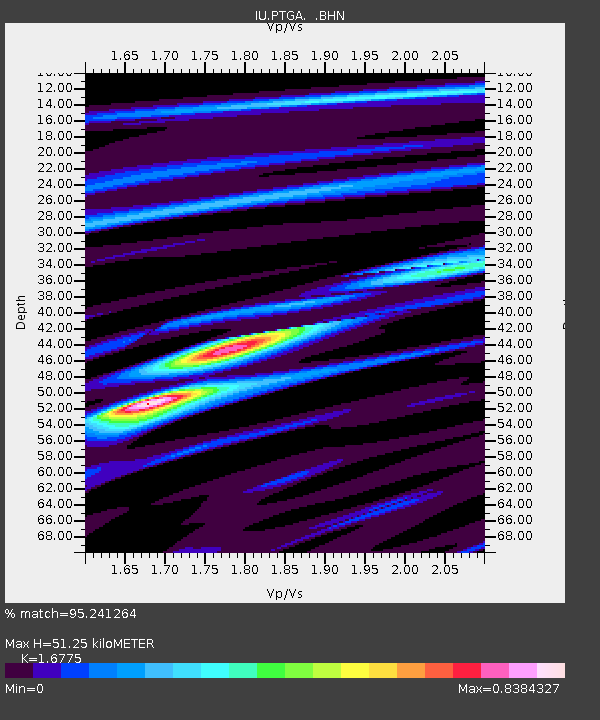
PTGA Pitinga, Brazil - Earthquake Result Viewer
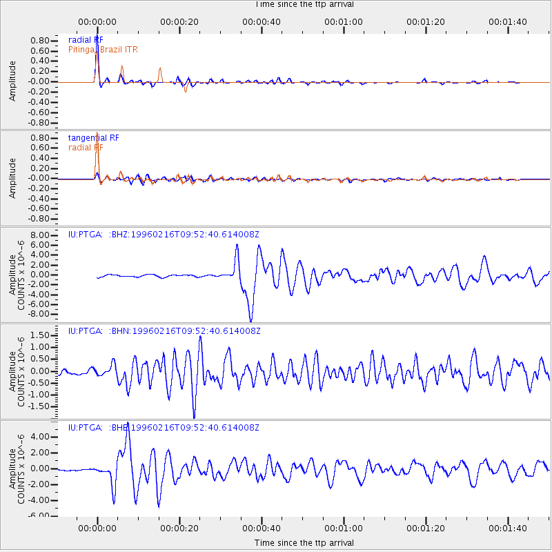
Earthquake location: North Of Ascension Island
Earthquake latitude/longitude: -1.5/-15.2
Earthquake time(UTC): 1996/02/16 (047) 09:44:58 GMT
Earthquake Depth: 10 km
Earthquake Magnitude: 6.0 MB, 6.3 MS, 6.5 UNKNOWN, 6.4 MW
Earthquake Catalog/Contributor: WHDF/NEIC
Network: IU Global Seismograph Network (GSN - IRIS/USGS)
Station: PTGA Pitinga, Brazil
Lat/Lon: 0.73 S/59.97 W
Elevation: 237 m
Distance: 44.7 deg
Az: 270.496 deg
Baz: 91.418 deg
Ray Param: 0.07172933
Estimated Moho Depth: 51.25 km
Estimated Crust Vp/Vs: 1.68
Assumed Crust Vp: 6.498 km/s
Estimated Crust Vs: 3.873 km/s
Estimated Crust Poisson's Ratio: 0.22
Radial Match: 95.241264 %
Radial Bump: 226
Transverse Match: 89.7521 %
Transverse Bump: 400
SOD ConfigId: 6273
Insert Time: 2010-03-04 20:56:20.504 +0000
GWidth: 2.5
Max Bumps: 400
Tol: 0.001

Signal To Noise

ChannelStoNSTALTA
IU:PTGA: :BHN:19960216T09:52:40.614008Z1.80928812.3504766E-71.2991168E-7
IU:PTGA: :BHE:19960216T09:52:40.614008Z9.8437191.4716808E-61.4950456E-7
IU:PTGA: :BHZ:19960216T09:52:40.614008Z9.6444112.1963742E-62.2773547E-7
Arrivals
Ps5.7 SECOND
PpPs20 SECOND
PsPs/PpSs25 SECOND