
PTGA Pitinga, Brazil - Earthquake Result Viewer
| ||||||||||||||||||
| ||||||||||||||||||
| ||||||||||||||||||
|
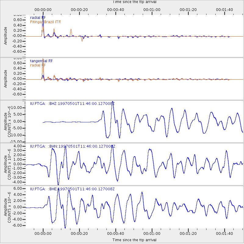
Signal To Noise
| Channel | StoN | STA | LTA |
| IU:PTGA: :BHN:19970501T11:46:00.127008Z | 18.31748 | 1.4030181E-6 | 7.6594496E-8 |
| IU:PTGA: :BHE:19970501T11:46:00.127008Z | 19.722988 | 1.9525087E-6 | 9.89966E-8 |
| IU:PTGA: :BHZ:19970501T11:46:00.127008Z | 30.125223 | 4.2670617E-6 | 1.4164416E-7 |
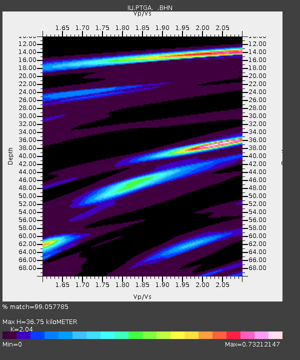
| Arrivals | |
| Ps | 6.2 SECOND |
| PpPs | 16 SECOND |
| PsPs/PpSs | 23 SECOND |

