
PTGA Pitinga, Brazil - Earthquake Result Viewer
| ||||||||||||||||||
| ||||||||||||||||||
| ||||||||||||||||||
|
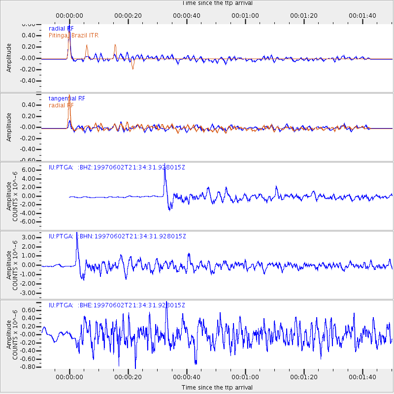
Signal To Noise
| Channel | StoN | STA | LTA |
| IU:PTGA: :BHN:19970602T21:34:31.928015Z | 17.553293 | 1.0950616E-6 | 6.238496E-8 |
| IU:PTGA: :BHE:19970602T21:34:31.928015Z | 1.7241714 | 1.6230213E-7 | 9.4133405E-8 |
| IU:PTGA: :BHZ:19970602T21:34:31.928015Z | 24.761839 | 2.2902293E-6 | 9.2490275E-8 |
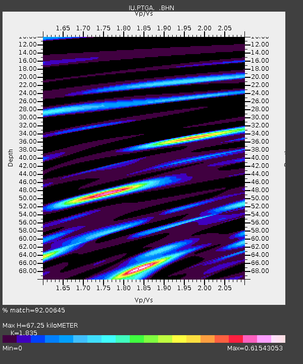
| Arrivals | |
| Ps | 9.0 SECOND |
| PpPs | 28 SECOND |
| PsPs/PpSs | 37 SECOND |

