You are here: Home > Network List > TA - USArray Transportable Network (new EarthScope stations) Stations List
> Station X43A Marvell, AR, USA > Earthquake Result Viewer
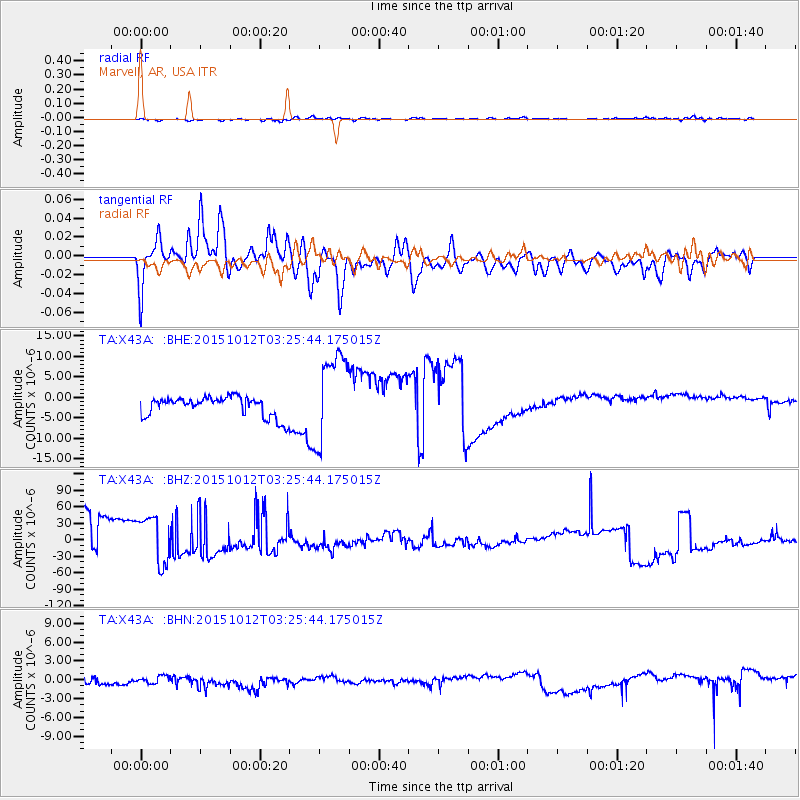
X43A Marvell, AR, USA - Earthquake Result Viewer
*The percent match for this event was below the threshold and hence no stack was calculated.
| Earthquake location: |
Near Coast Of Central Chile |
| Earthquake latitude/longitude: |
-31.2/-71.8 |
| Earthquake time(UTC): |
2015/10/12 (285) 03:15:19 GMT |
| Earthquake Depth: |
21 km |
| Earthquake Magnitude: |
5.6 MWW, 5.3 MWR, 5.5 MWB |
| Earthquake Catalog/Contributor: |
NEIC PDE/NEIC COMCAT |
|
| Network: |
TA USArray Transportable Network (new EarthScope stations) |
| Station: |
X43A Marvell, AR, USA |
| Lat/Lon: |
34.52 N/90.88 W |
| Elevation: |
53 m |
|
| Distance: |
67.8 deg |
| Az: |
343.066 deg |
| Baz: |
162.404 deg |
| Ray Param: |
$rayparam |
*The percent match for this event was below the threshold and hence was not used in the summary stack. |
|
| Radial Match: |
53.586426 % |
| Radial Bump: |
400 |
| Transverse Match: |
58.6904 % |
| Transverse Bump: |
400 |
| SOD ConfigId: |
7422571 |
| Insert Time: |
2019-04-21 02:36:14.278 +0000 |
| GWidth: |
2.5 |
| Max Bumps: |
400 |
| Tol: |
0.001 |
|
Signal To Noise
| Channel | StoN | STA | LTA |
| TA:X43A: :BHZ:20151012T03:25:44.175015Z | 1.4022907 | 4.498915E-5 | 3.208261E-5 |
| TA:X43A: :BHN:20151012T03:25:44.175015Z | 1.0670899 | 6.722588E-7 | 6.2999266E-7 |
| TA:X43A: :BHE:20151012T03:25:44.175015Z | 4.5638022 | 1.1120014E-5 | 2.436568E-6 |
| Arrivals |
| Ps | |
| PpPs | |
| PsPs/PpSs | |


