You are here: Home > Network List > AK - Alaska Regional Network Stations List
> Station CUT Chulitna, AK, USA > Earthquake Result Viewer
CUT Chulitna, AK, USA - Earthquake Result Viewer
*The percent match for this event was below the threshold and hence no stack was calculated.
| Earthquake location: |
East Of Kuril Islands |
| Earthquake latitude/longitude: |
48.9/156.2 |
| Earthquake time(UTC): |
2015/10/14 (287) 05:43:07 GMT |
| Earthquake Depth: |
6.0 km |
| Earthquake Magnitude: |
5.6 MB, 5.9 MWB |
| Earthquake Catalog/Contributor: |
NEIC PDE/NEIC COMCAT |
|
| Network: |
AK Alaska Regional Network |
| Station: |
CUT Chulitna, AK, USA |
| Lat/Lon: |
62.41 N/150.26 W |
| Elevation: |
574 m |
|
| Distance: |
32.1 deg |
| Az: |
44.828 deg |
| Baz: |
270.198 deg |
| Ray Param: |
$rayparam |
*The percent match for this event was below the threshold and hence was not used in the summary stack. |
|
| Radial Match: |
61.632446 % |
| Radial Bump: |
400 |
| Transverse Match: |
49.94109 % |
| Transverse Bump: |
400 |
| SOD ConfigId: |
7422571 |
| Insert Time: |
2019-04-21 02:42:08.627 +0000 |
| GWidth: |
2.5 |
| Max Bumps: |
400 |
| Tol: |
0.001 |
|
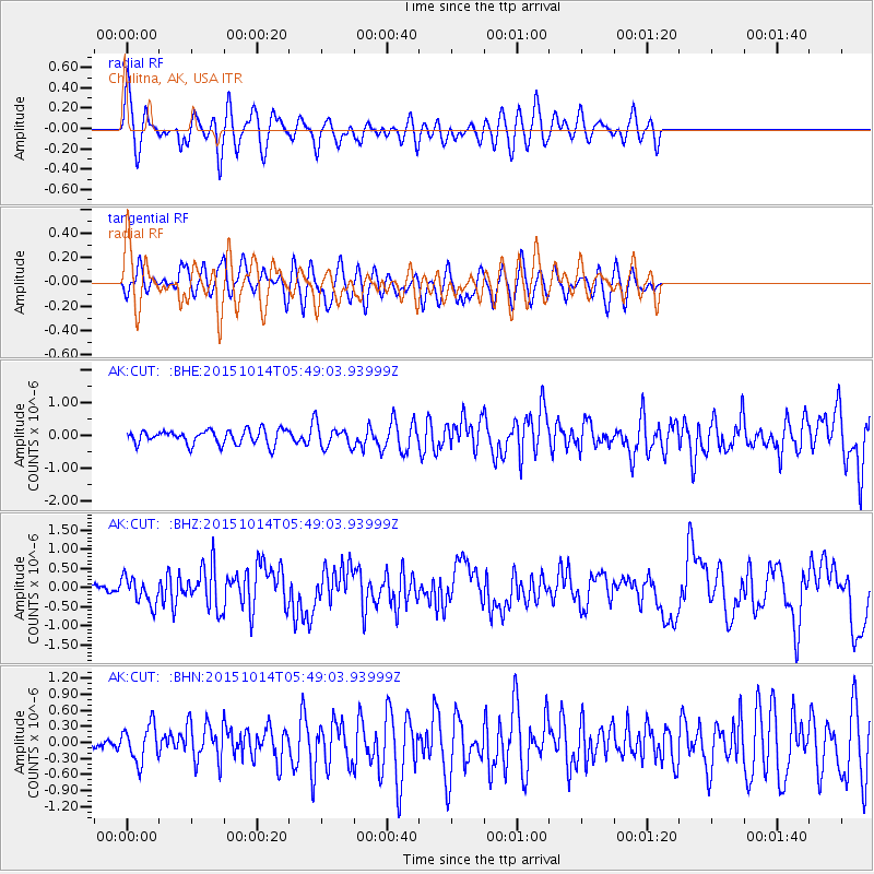
Signal To Noise
| Channel | StoN | STA | LTA |
| AK:CUT: :BHZ:20151014T05:49:03.93999Z | 2.7097547 | 3.4442928E-7 | 1.2710719E-7 |
| AK:CUT: :BHN:20151014T05:49:03.93999Z | 1.1602684 | 3.4836435E-7 | 3.0024464E-7 |
| AK:CUT: :BHE:20151014T05:49:03.93999Z | 1.2706875 | 2.7911162E-7 | 2.1965401E-7 |
| Arrivals |
| Ps | |
| PpPs | |
| PsPs/PpSs | |


