TATO Taipei, Taiwan - Earthquake Result Viewer
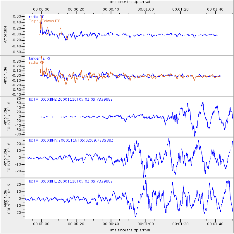
Earthquake location: New Ireland Region, P.N.G.
Earthquake latitude/longitude: -4.0/152.2
Earthquake time(UTC): 2000/11/16 (321) 04:54:56 GMT
Earthquake Depth: 33 km
Earthquake Magnitude: 6.0 MB, 8.2 MS, 8.0 MW, 8.0 ME
Earthquake Catalog/Contributor: WHDF/NEIC
Network: IU Global Seismograph Network (GSN - IRIS/USGS)
Station: TATO Taipei, Taiwan
Lat/Lon: 24.98 N/121.49 E
Elevation: 53 m
Distance: 41.4 deg
Az: 315.589 deg
Baz: 129.715 deg
Ray Param: 0.073727295
Estimated Moho Depth: 29.25 km
Estimated Crust Vp/Vs: 1.60
Assumed Crust Vp: 6.289 km/s
Estimated Crust Vs: 3.93 km/s
Estimated Crust Poisson's Ratio: 0.18
Radial Match: 88.968254 %
Radial Bump: 400
Transverse Match: 90.591866 %
Transverse Bump: 400
SOD ConfigId: 3744
Insert Time: 2010-03-04 20:56:53.310 +0000
GWidth: 2.5
Max Bumps: 400
Tol: 0.001

Signal To Noise

ChannelStoNSTALTA
IU:TATO:00:BHN:20001116T05:02:09.733988Z1.29340921.1166854E-68.633659E-7
IU:TATO:00:BHE:20001116T05:02:09.733988Z1.32632231.6297926E-61.2288058E-6
IU:TATO:00:BHZ:20001116T05:02:09.733988Z1.63068471.4416629E-68.840844E-7
Arrivals
Ps3.0 SECOND
PpPs11 SECOND
PsPs/PpSs14 SECOND