You are here: Home > Network List > HV - Hawaiian Volcano Observatory Network Stations List
> Station MLOD Mauna Loa, Hawaii Digital > Earthquake Result Viewer
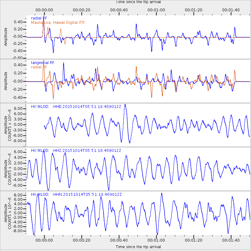
MLOD Mauna Loa, Hawaii Digital - Earthquake Result Viewer
*The percent match for this event was below the threshold and hence no stack was calculated.
| Earthquake location: |
East Of Kuril Islands |
| Earthquake latitude/longitude: |
48.9/156.2 |
| Earthquake time(UTC): |
2015/10/14 (287) 05:43:07 GMT |
| Earthquake Depth: |
6.0 km |
| Earthquake Magnitude: |
5.6 MB, 5.9 MWB |
| Earthquake Catalog/Contributor: |
NEIC PDE/NEIC COMCAT |
|
| Network: |
HV Hawaiian Volcano Observatory Network |
| Station: |
MLOD Mauna Loa, Hawaii Digital |
| Lat/Lon: |
19.49 N/155.39 W |
| Elevation: |
2044 m |
|
| Distance: |
48.5 deg |
| Az: |
109.629 deg |
| Baz: |
318.74 deg |
| Ray Param: |
$rayparam |
*The percent match for this event was below the threshold and hence was not used in the summary stack. |
|
| Radial Match: |
60.07966 % |
| Radial Bump: |
400 |
| Transverse Match: |
61.56557 % |
| Transverse Bump: |
400 |
| SOD ConfigId: |
7422571 |
| Insert Time: |
2019-04-21 02:45:13.119 +0000 |
| GWidth: |
2.5 |
| Max Bumps: |
400 |
| Tol: |
0.001 |
|
Signal To Noise
| Channel | StoN | STA | LTA |
| HV:MLOD: :HHZ:20151014T05:51:19.469012Z | 2.2978516 | 5.142862E-6 | 2.2381175E-6 |
| HV:MLOD: :HHN:20151014T05:51:19.469012Z | 0.9452409 | 4.9097184E-6 | 5.194145E-6 |
| HV:MLOD: :HHE:20151014T05:51:19.469012Z | 1.2995268 | 3.4303553E-6 | 2.6396956E-6 |
| Arrivals |
| Ps | |
| PpPs | |
| PsPs/PpSs | |


