You are here: Home > Network List > KN - Kyrgyz Seismic Telemetry Network Stations List
> Station CHM KN.CHM > Earthquake Result Viewer
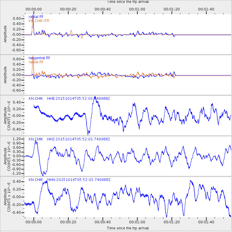
CHM KN.CHM - Earthquake Result Viewer
*The percent match for this event was below the threshold and hence no stack was calculated.
| Earthquake location: |
East Of Kuril Islands |
| Earthquake latitude/longitude: |
48.9/156.2 |
| Earthquake time(UTC): |
2015/10/14 (287) 05:43:07 GMT |
| Earthquake Depth: |
6.0 km |
| Earthquake Magnitude: |
5.6 MB, 5.9 MWB |
| Earthquake Catalog/Contributor: |
NEIC PDE/NEIC COMCAT |
|
| Network: |
KN Kyrgyz Seismic Telemetry Network |
| Station: |
CHM KN.CHM |
| Lat/Lon: |
43.00 N/74.75 E |
| Elevation: |
655 m |
|
| Distance: |
54.4 deg |
| Az: |
296.855 deg |
| Baz: |
53.439 deg |
| Ray Param: |
$rayparam |
*The percent match for this event was below the threshold and hence was not used in the summary stack. |
|
| Radial Match: |
64.90044 % |
| Radial Bump: |
400 |
| Transverse Match: |
34.046402 % |
| Transverse Bump: |
400 |
| SOD ConfigId: |
7422571 |
| Insert Time: |
2019-04-21 02:45:39.010 +0000 |
| GWidth: |
2.5 |
| Max Bumps: |
400 |
| Tol: |
0.001 |
|
Signal To Noise
| Channel | StoN | STA | LTA |
| KN:CHM: :HHZ:20151014T05:52:03.749988Z | 27.483898 | 7.4748425E-7 | 2.7197169E-8 |
| KN:CHM: :HHN:20151014T05:52:03.749988Z | 1.2996645 | 3.2448628E-7 | 2.4966928E-7 |
| KN:CHM: :HHE:20151014T05:52:03.749988Z | 3.1195965 | 3.593248E-7 | 1.151831E-7 |
| Arrivals |
| Ps | |
| PpPs | |
| PsPs/PpSs | |


