TATO Taipei, Taiwan - Earthquake Result Viewer
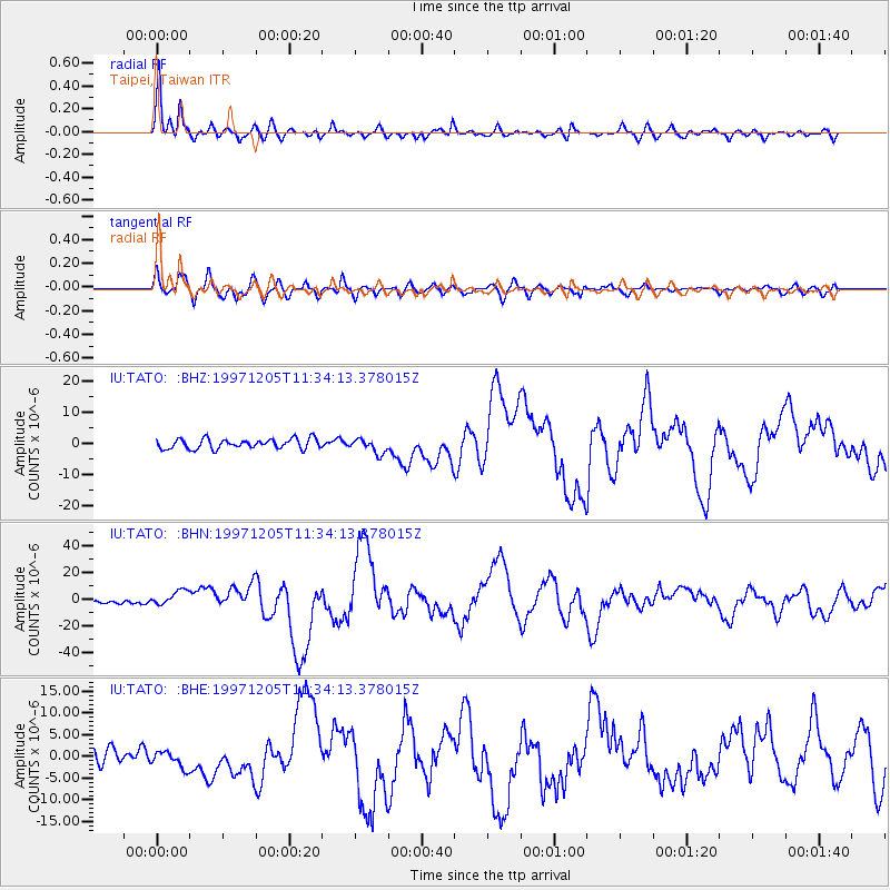
Earthquake location: Near East Coast Of Kamchatka
Earthquake latitude/longitude: 54.8/162.0
Earthquake time(UTC): 1997/12/05 (339) 11:26:54 GMT
Earthquake Depth: 33 km
Earthquake Magnitude: 6.3 MB, 7.6 MS, 7.9 UNKNOWN, 7.3 ME
Earthquake Catalog/Contributor: WHDF/NEIC
Network: IU Global Seismograph Network (GSN - IRIS/USGS)
Station: TATO Taipei, Taiwan
Lat/Lon: 24.98 N/121.49 E
Elevation: 53 m
Distance: 42.1 deg
Az: 241.55 deg
Baz: 34.081 deg
Ray Param: 0.07328135
Estimated Moho Depth: 23.25 km
Estimated Crust Vp/Vs: 1.90
Assumed Crust Vp: 6.289 km/s
Estimated Crust Vs: 3.305 km/s
Estimated Crust Poisson's Ratio: 0.31
Radial Match: 95.05042 %
Radial Bump: 400
Transverse Match: 86.113396 %
Transverse Bump: 400
SOD ConfigId: 4480
Insert Time: 2010-03-04 20:57:23.176 +0000
GWidth: 2.5
Max Bumps: 400
Tol: 0.001

Signal To Noise

ChannelStoNSTALTA
IU:TATO: :BHN:19971205T11:34:13.378015Z6.0119245.758367E-69.578243E-7
IU:TATO: :BHE:19971205T11:34:13.378015Z1.60116341.9333845E-61.2074873E-6
IU:TATO: :BHZ:19971205T11:34:13.378015Z1.45582072.3251973E-61.597173E-6
Arrivals
Ps3.5 SECOND
PpPs10 SECOND
PsPs/PpSs14 SECOND