TATO Taipei, Taiwan - Earthquake Result Viewer
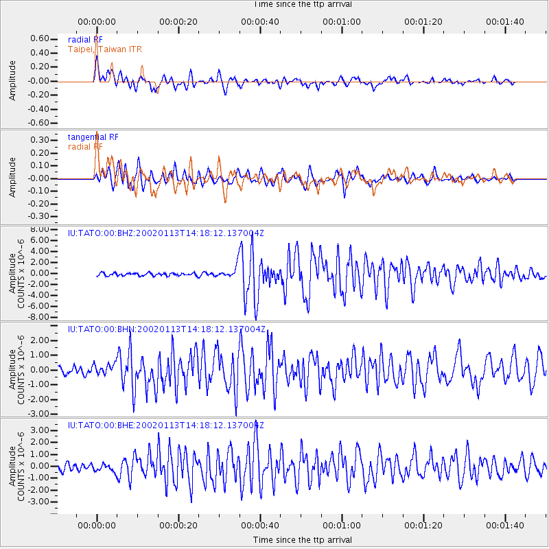
Earthquake location: New Britain Region, P.N.G.
Earthquake latitude/longitude: -5.7/151.1
Earthquake time(UTC): 2002/01/13 (013) 14:10:56 GMT
Earthquake Depth: 44 km
Earthquake Magnitude: 5.9 MB, 6.4 MS, 6.3 MW, 6.3 MW
Earthquake Catalog/Contributor: WHDF/NEIC
Network: IU Global Seismograph Network (GSN - IRIS/USGS)
Station: TATO Taipei, Taiwan
Lat/Lon: 24.98 N/121.49 E
Elevation: 53 m
Distance: 41.9 deg
Az: 317.853 deg
Baz: 132.622 deg
Ray Param: 0.07339073
Estimated Moho Depth: 25.25 km
Estimated Crust Vp/Vs: 1.88
Assumed Crust Vp: 6.289 km/s
Estimated Crust Vs: 3.354 km/s
Estimated Crust Poisson's Ratio: 0.30
Radial Match: 89.65957 %
Radial Bump: 400
Transverse Match: 88.829636 %
Transverse Bump: 400
SOD ConfigId: 20082
Insert Time: 2010-03-04 20:57:30.985 +0000
GWidth: 2.5
Max Bumps: 400
Tol: 0.001

Signal To Noise

ChannelStoNSTALTA
IU:TATO:00:BHN:20020113T14:18:12.137004Z1.30482693.7083552E-72.8420286E-7
IU:TATO:00:BHE:20020113T14:18:12.137004Z1.14327293.1217473E-72.7305356E-7
IU:TATO:00:BHZ:20020113T14:18:12.137004Z5.05988741.2514474E-62.4732714E-7
Arrivals
Ps3.7 SECOND
PpPs11 SECOND
PsPs/PpSs15 SECOND