You are here: Home > Network List > US - United States National Seismic Network Stations List
> Station CBKS Cedar Bluff, Kansas, USA > Earthquake Result Viewer
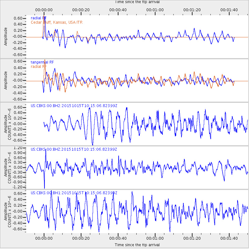
CBKS Cedar Bluff, Kansas, USA - Earthquake Result Viewer
*The percent match for this event was below the threshold and hence no stack was calculated.
| Earthquake location: |
Ecuador |
| Earthquake latitude/longitude: |
-2.5/-78.8 |
| Earthquake time(UTC): |
2015/10/15 (288) 10:07:28 GMT |
| Earthquake Depth: |
97 km |
| Earthquake Magnitude: |
5.4 mww |
| Earthquake Catalog/Contributor: |
NEIC PDE/us |
|
| Network: |
US United States National Seismic Network |
| Station: |
CBKS Cedar Bluff, Kansas, USA |
| Lat/Lon: |
38.81 N/99.74 W |
| Elevation: |
677 m |
|
| Distance: |
45.4 deg |
| Az: |
336.889 deg |
| Baz: |
149.87 deg |
| Ray Param: |
$rayparam |
*The percent match for this event was below the threshold and hence was not used in the summary stack. |
|
| Radial Match: |
60.057266 % |
| Radial Bump: |
400 |
| Transverse Match: |
60.39731 % |
| Transverse Bump: |
400 |
| SOD ConfigId: |
7422571 |
| Insert Time: |
2019-04-21 02:58:12.317 +0000 |
| GWidth: |
2.5 |
| Max Bumps: |
400 |
| Tol: |
0.001 |
|
Signal To Noise
| Channel | StoN | STA | LTA |
| US:CBKS:00:BHZ:20151015T10:15:06.82399Z | 2.1126966 | 4.148324E-7 | 1.963521E-7 |
| US:CBKS:00:BH1:20151015T10:15:06.82399Z | 0.90577096 | 3.0593984E-7 | 3.3776732E-7 |
| US:CBKS:00:BH2:20151015T10:15:06.82399Z | 1.3822925 | 2.8898785E-7 | 2.0906418E-7 |
| Arrivals |
| Ps | |
| PpPs | |
| PsPs/PpSs | |


